Six Days in Utah
June-July 2025
June-July 2025
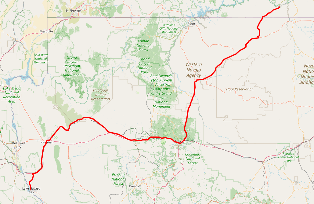
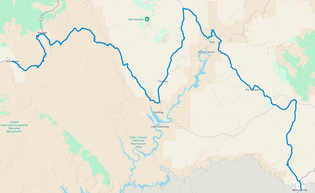
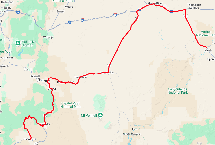
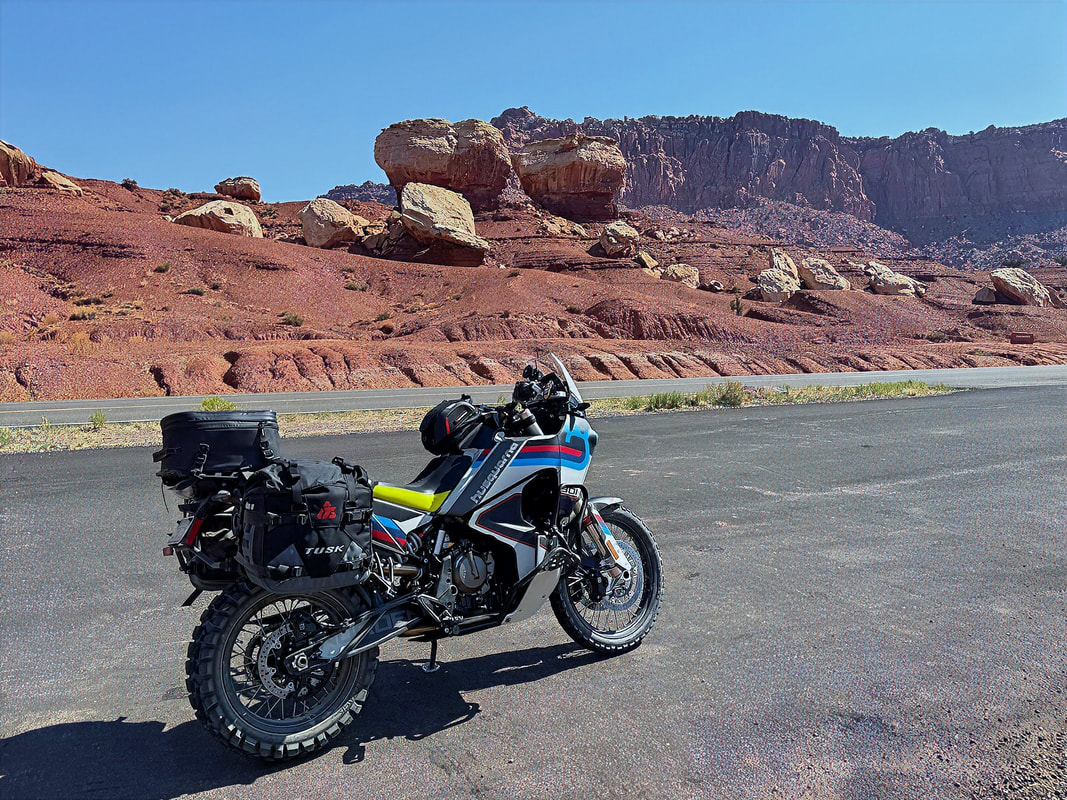
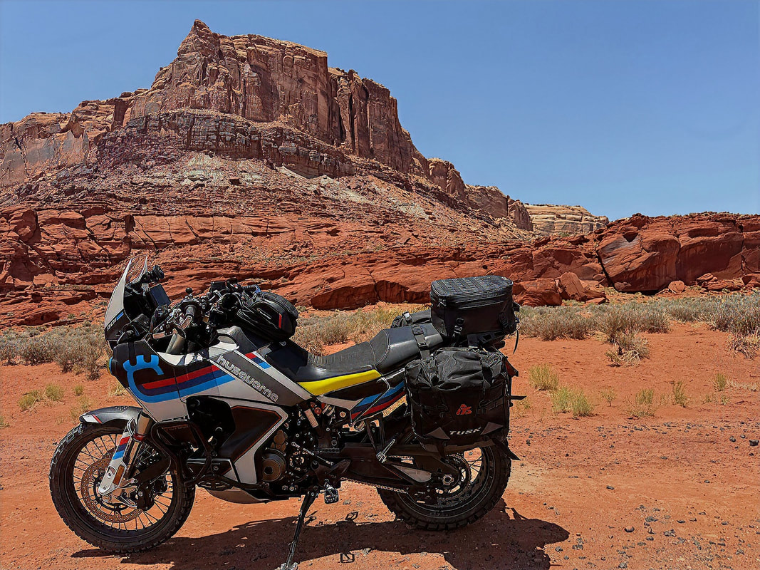
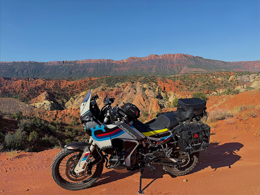
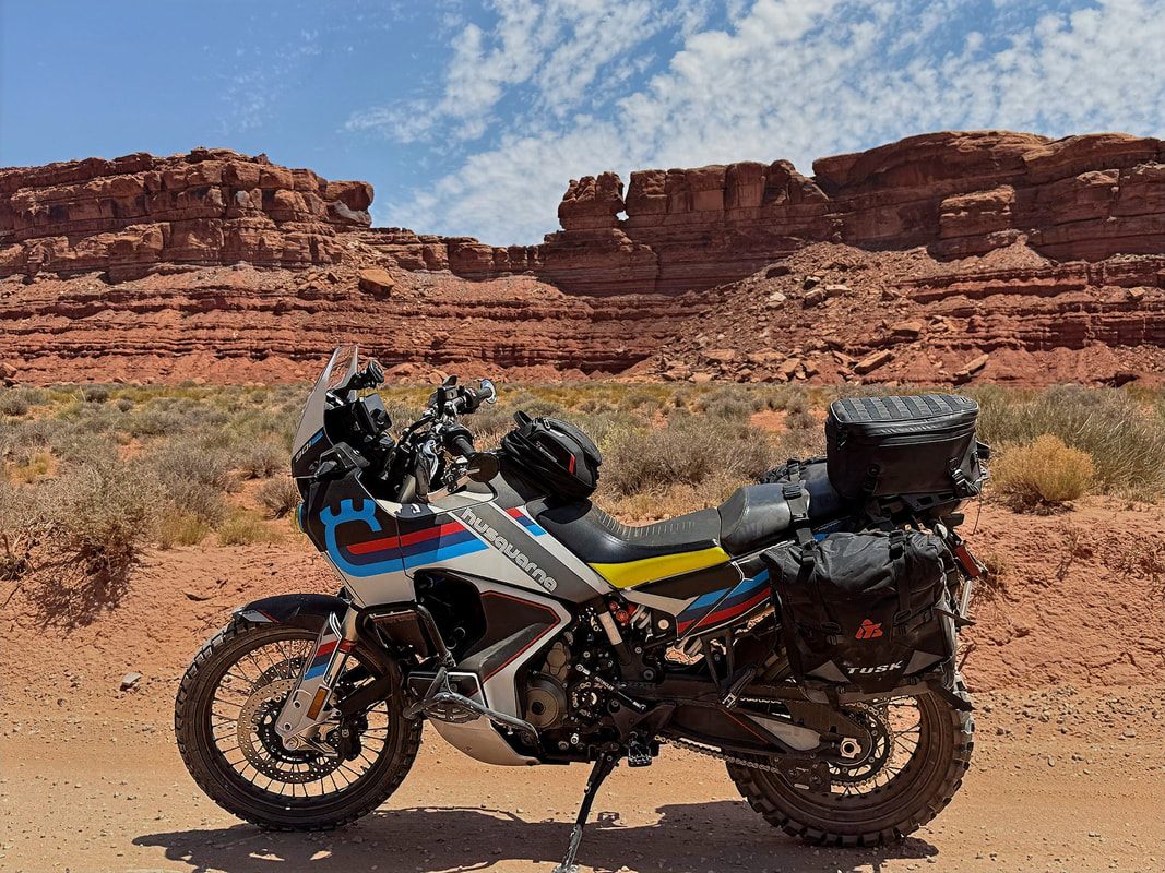
I carved out six days to stretch the legs of my '23 Norden 901 and get some quality time in the saddle. My original plan was to hit some SoCal BDR tracks and then loop up into the Sierra passes, but the forecast had other ideas. With temps climbing past 100°F across much of SoCal, I pivoted and set my sights on southeastern Utah. Still hot, but manageable and worth it for the landscapes alone.
The plan:
The plan:
- Day 1 - Ride from Lake Havasu, AZ to Mexican Hat, UT
- Days 2- 5 - Explore the stunning backroads and scenery of SE Utah
- Day 6 - Return to Lake Havasu
Day 1 - Lake Havasu, AZ to Mexican Hat, UT
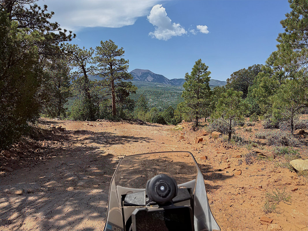
I rolled out of Lake Havasu early to beat the heat and hit the road heading northeast. After skirting through Kingman, I picked up a great stretch of old Route 66 between Kingman and Ash Fork—always a fun ride with some classic Americana vibes.
I rolled out of Lake Havasu early to beat the heat and hit the road heading northeast. After skirting through Kingman, I picked up a great stretch of old Route 66 between Kingman and Ash Fork—always a fun ride with some classic Americana vibes.
I filled up with gas in Seligman and took the obligatory Hwy 66 photo...

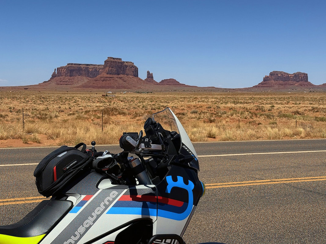
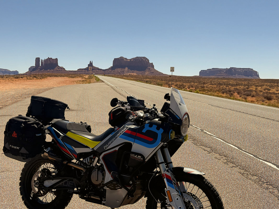
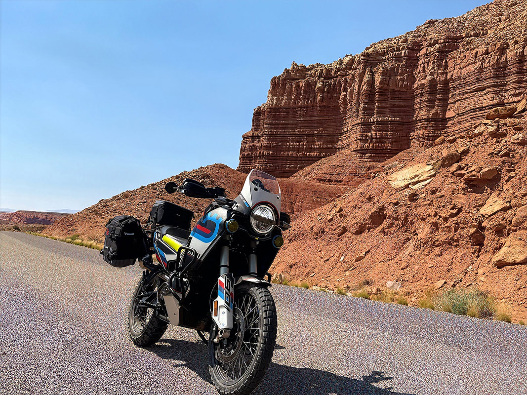
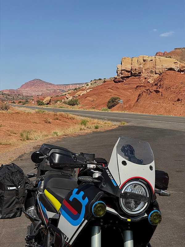
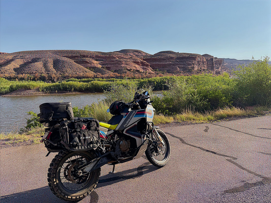
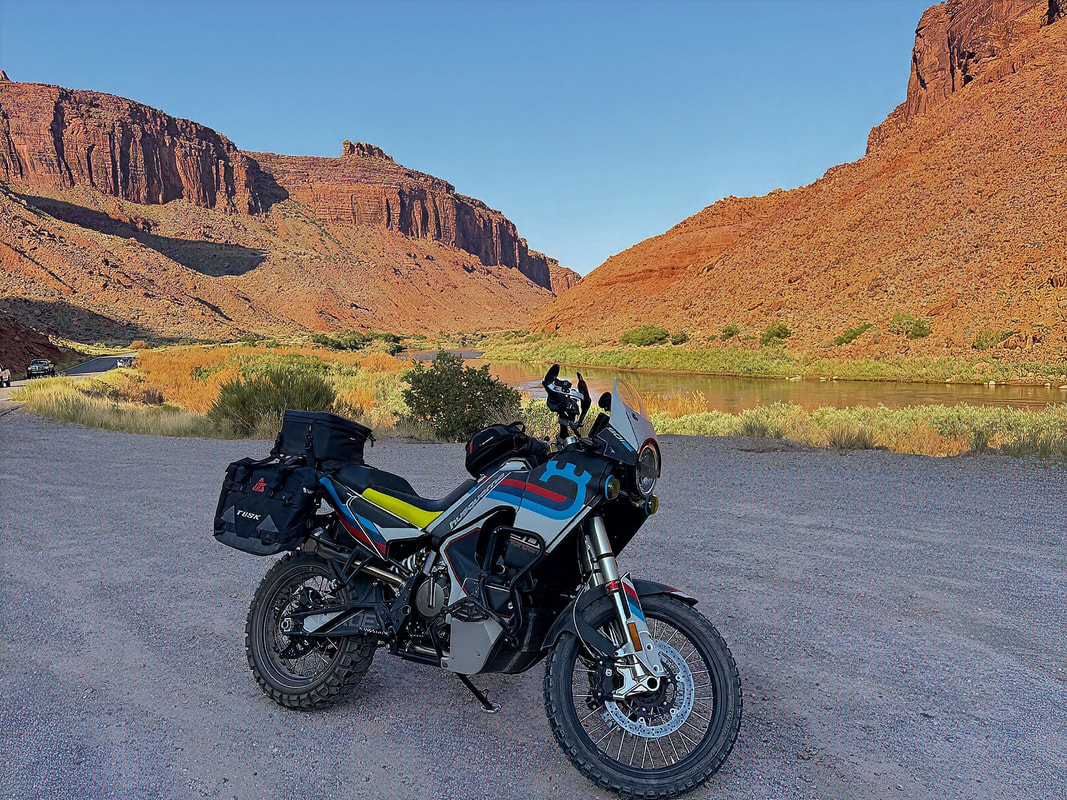
From there, it was a short hop onto I-40 heading east to Flagstaff, then north on Hwy 89 toward the red rocks. I continued through the Navajo Nation via Hwy 160, eventually connecting with Hwy 163, which delivered me right into Mexican Hat.
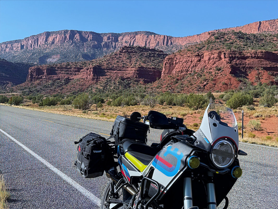
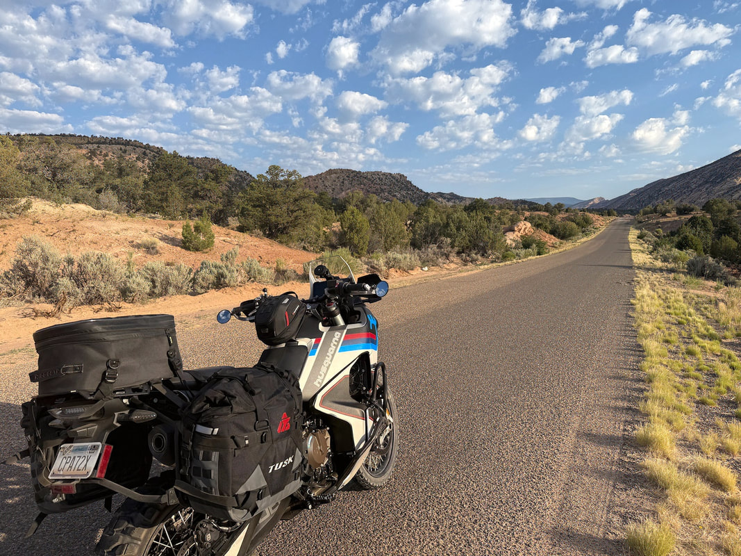
The scenery along the way kept getting better, and as I headed north on Hwy 163 out of Kayenta, those first glimpses of the red desert cliffs and wide-open vistas reminded me why I changed my route. SE Utah never disappoints.
The scenery along the way kept getting better, and as I headed north on Hwy 163 out of Kayenta, those first glimpses of the red desert cliffs and wide-open vistas reminded me why I changed my route. SE Utah never disappoints.
|
|
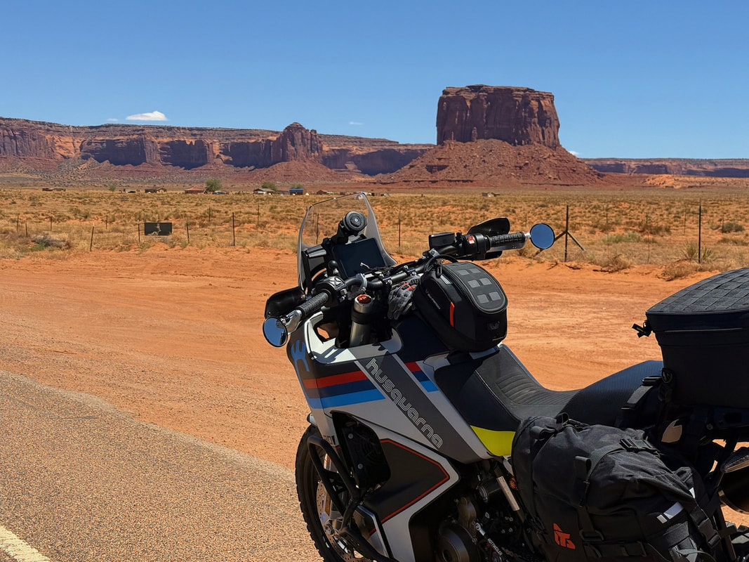
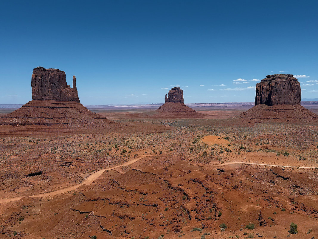
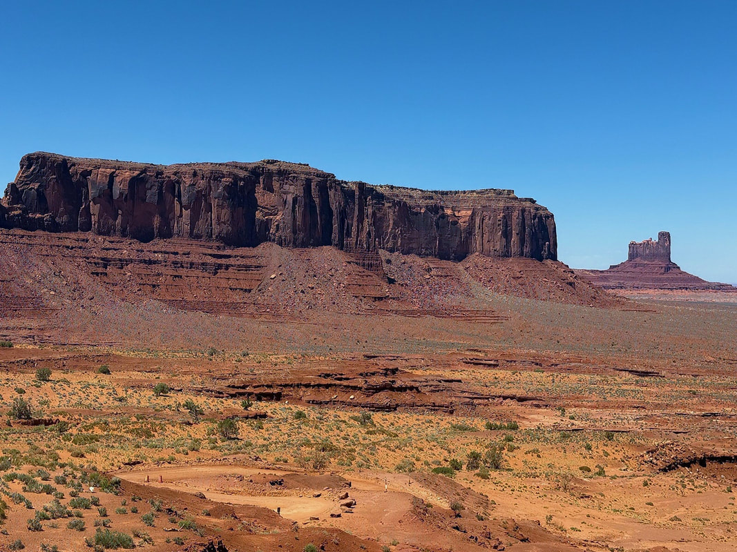
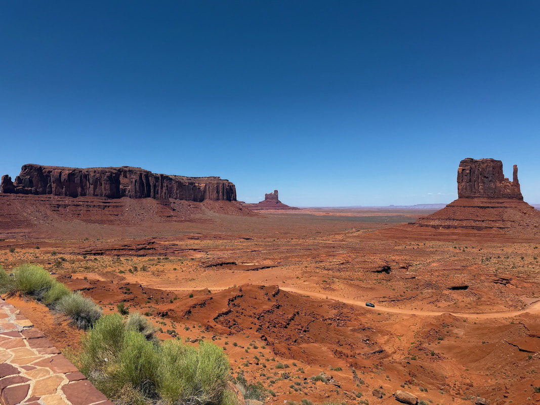
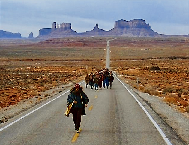
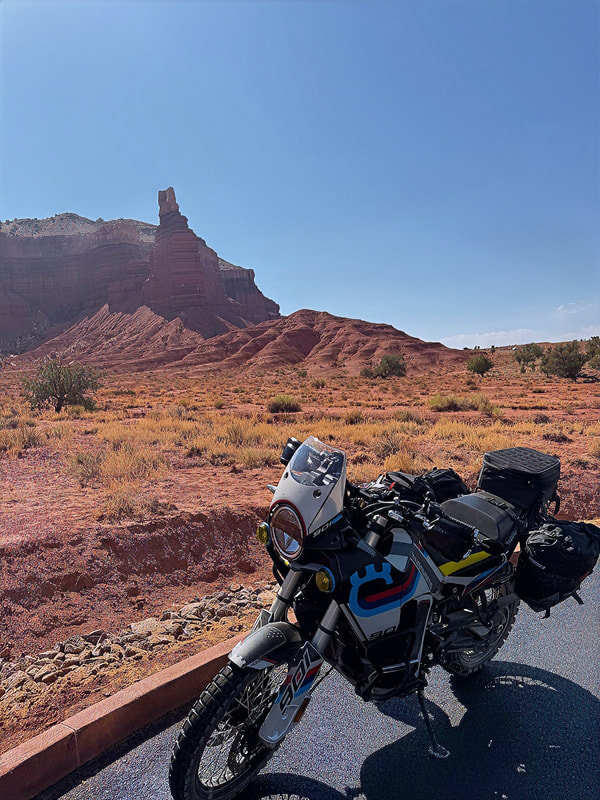
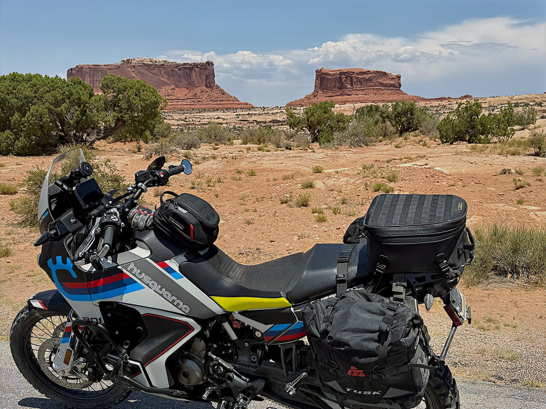
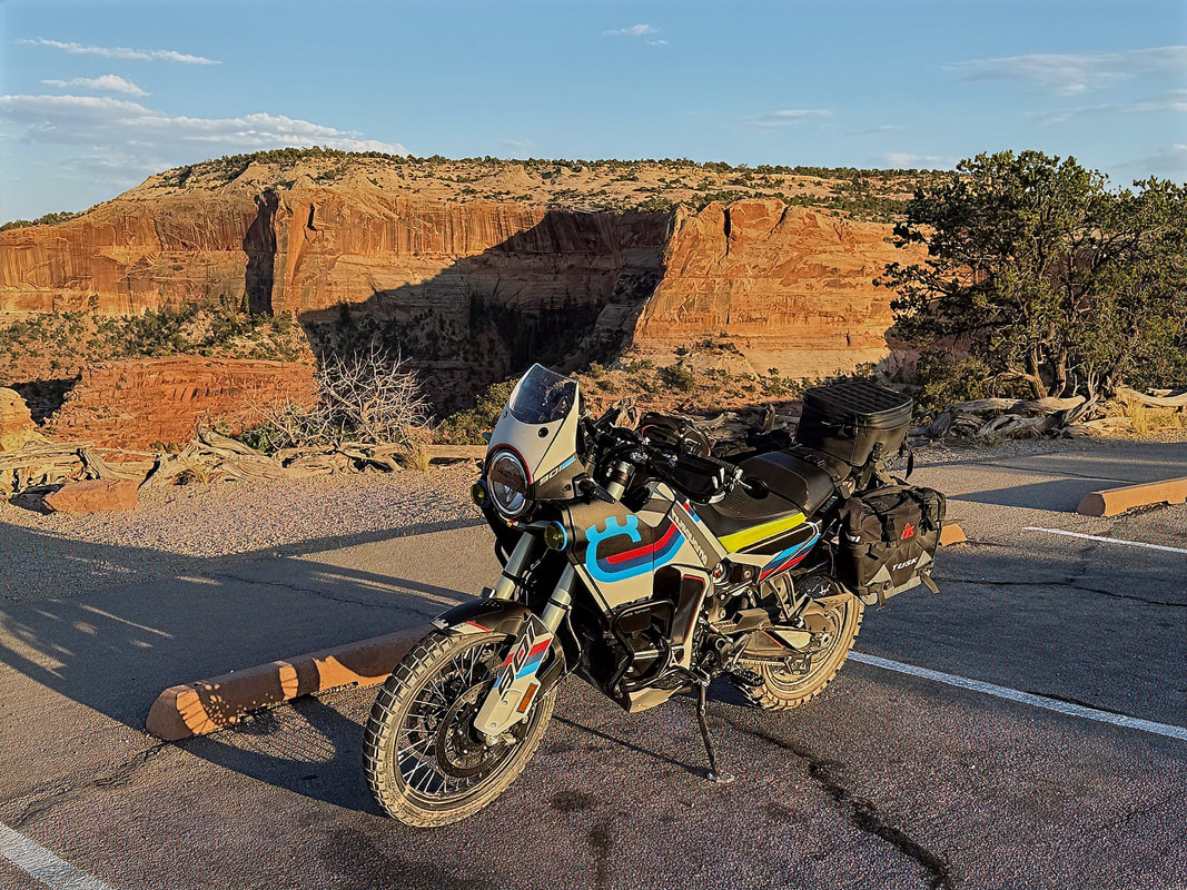
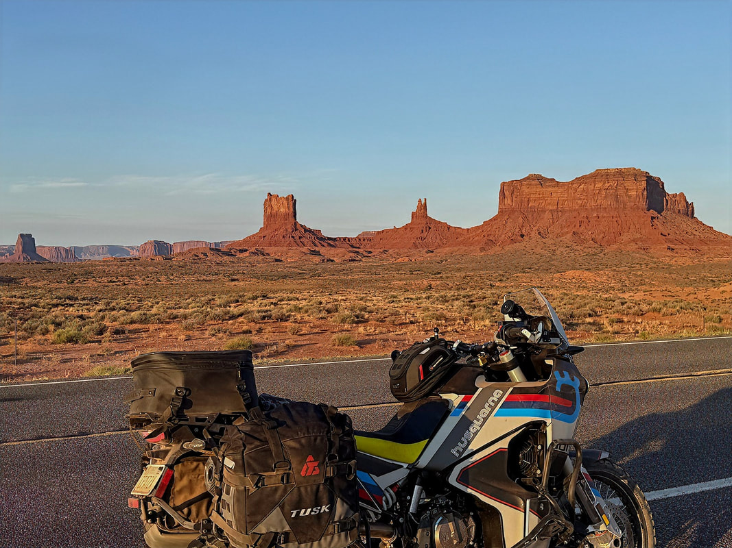
I decided to pay the $8 to enter the Monument Valley Navajo Tribal Park in order to take a few pics. The park has an excellent dirt loop road to get some great views of many of the outstanding monument features, but unfortunately motorcycles are not allowed - so I just took a few pics from the Visitor Center.
|
|
Stunning views!
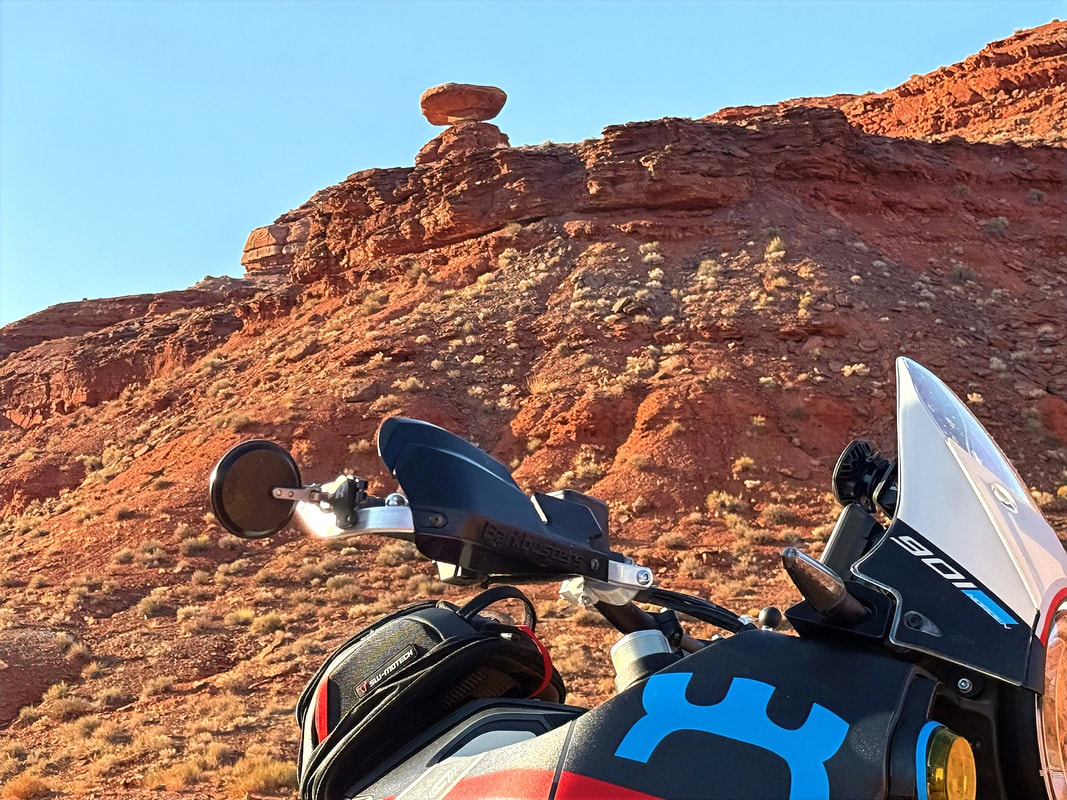
Between the Park and Mexican Hat is the iconic spot from the Forrest Gump movie where he decides to stop running. Now, there are turnouts so tourists (like me) can get pics with a similar view...
|
|
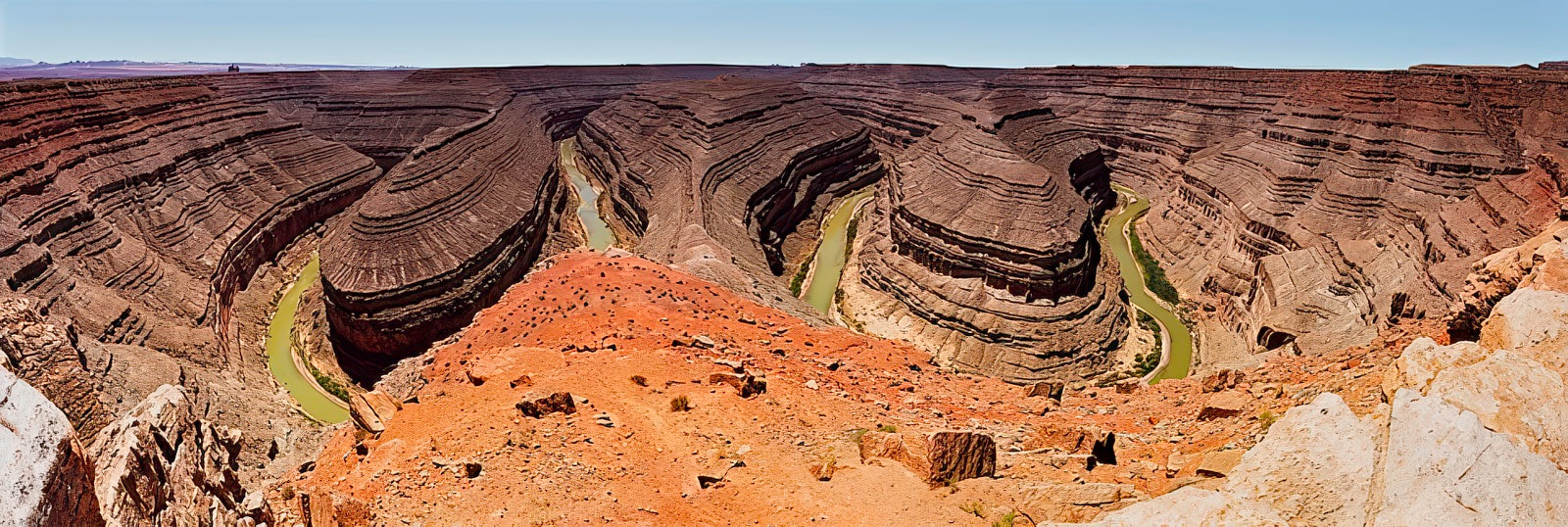
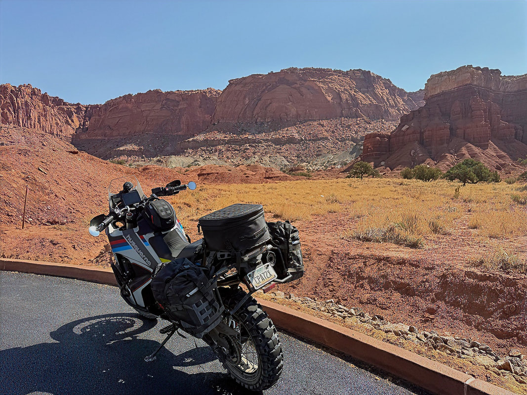
Mexican Hat is only about 15 miles north of here. It was still relatively early when I arrived in Mexican Hat, so I drove through town to visit Goosenecks State Park, where the San Juan River has carved some enormous gooseneck curves into the landscape.
I left Goosenecks Park, and rode back to Mexican Hat and the San Juan Inn, which would be home for the night - small. quiet, and a perfect jumping-off point for the days ahead.
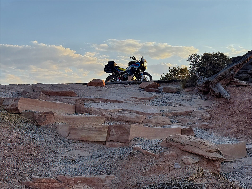
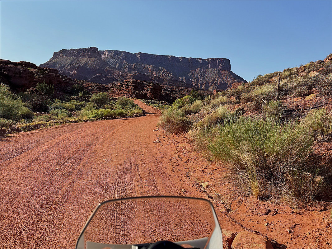
Day 2 - Mexican Hat to Escalante (via Moki Dugway and the Burr Trail)
Today's ride would include the Moki Dugway (a set of steep dirt switchbacks up Cedar Mesa), crossing the Hite Bridge, riding the infamous Burr Trail, and view the incredible scenery of Grand Staircase-Escalante National Monument.
I was up early and on the move by about 7:30 AM, rolling out of the San Juan Inn in Mexican Hat after a quick morning snack. That great morning light was already starting to hit the canyon walls. First order of business: a quick stop just outside of town to grab the obligatory photo of Mexican Hat Rock, the town’s quirky namesake. Always worth the detour, even if you’ve seen it before.
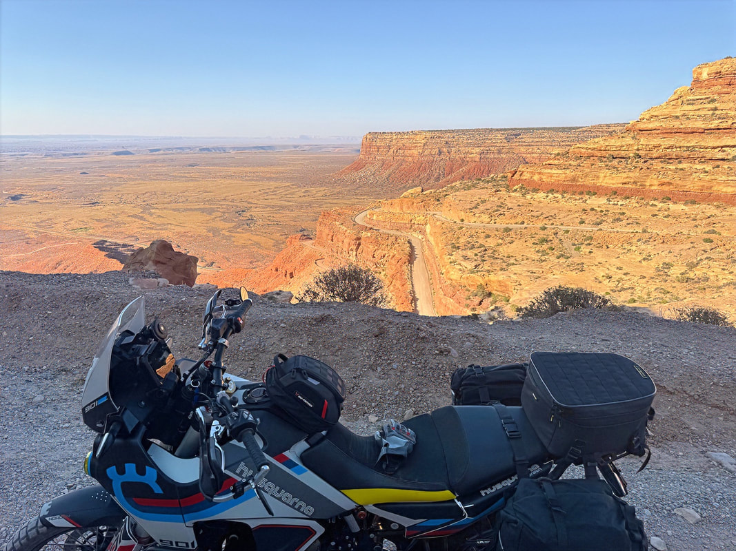
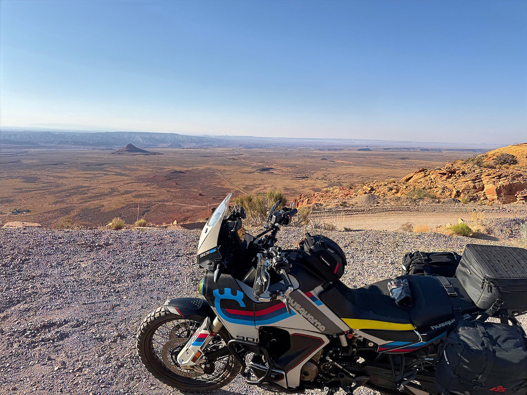
From there, I jumped on Hwy 261 heading north, just a short 7-mile stretch before reaching the Moki Dugway. If you haven’t ridden it, you’re in for a treat. It’s a series of steep, unpaved switchbacks carved into the face of Cedar Mesa, climbing about 1,200 feet in just under 3 miles. Built back in the ‘50s to haul uranium ore, it’s still a thrilling ride. The views looking back over the Valley of the Gods and out toward Monument Valley are absolutely jaw-dropping. I took my time up the switchbacks, partly to soak in the scenery and take some pics, and partly because loose gravel and hairpins on a loaded ADV bike are best handled with a bit of care.

|
|
|
|
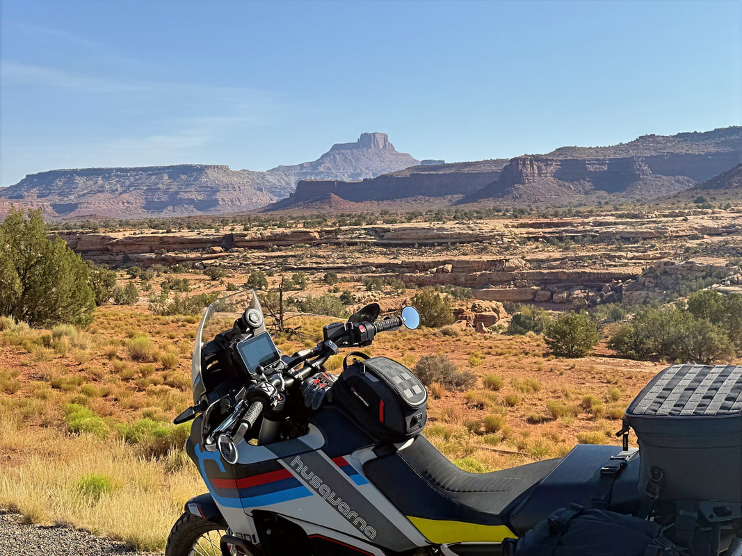
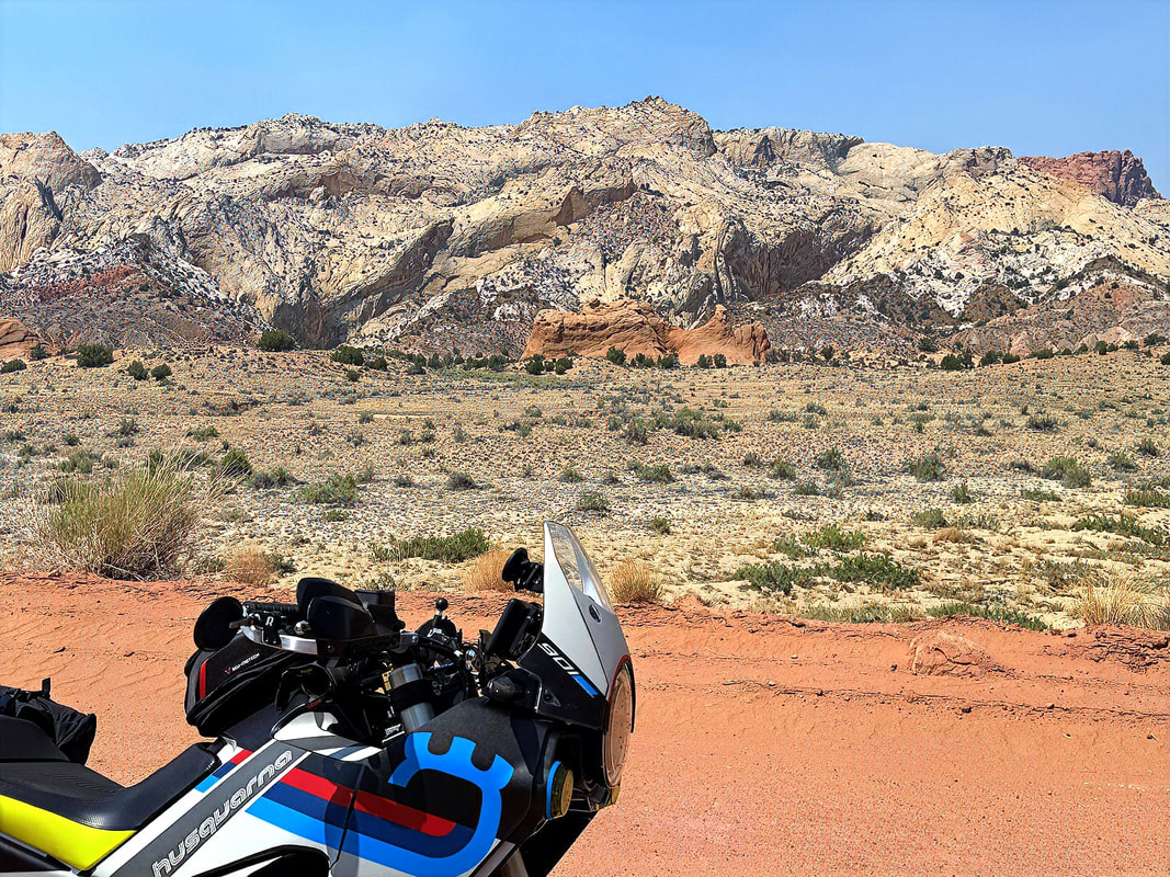
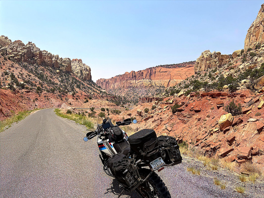
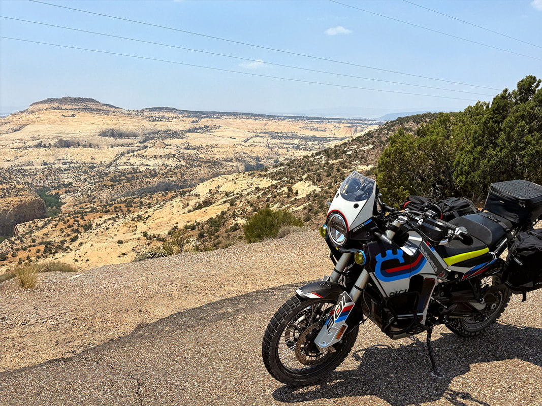
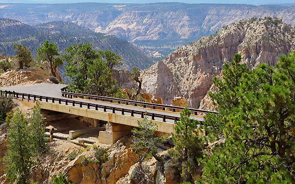
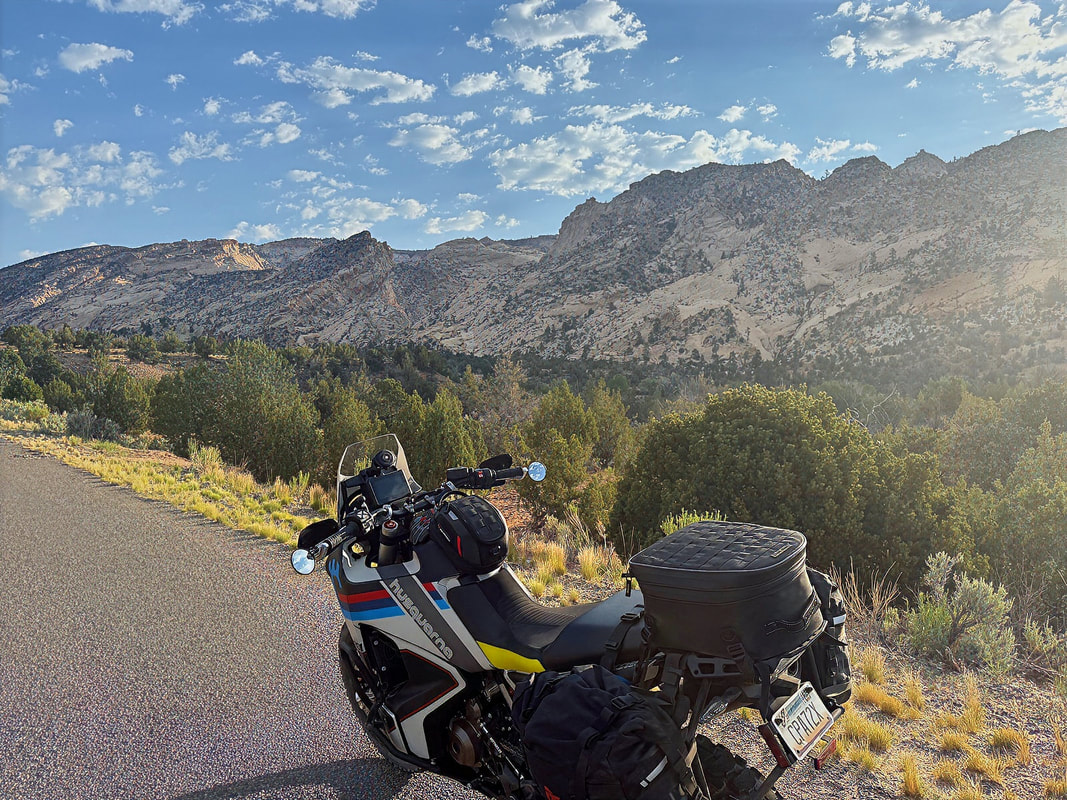
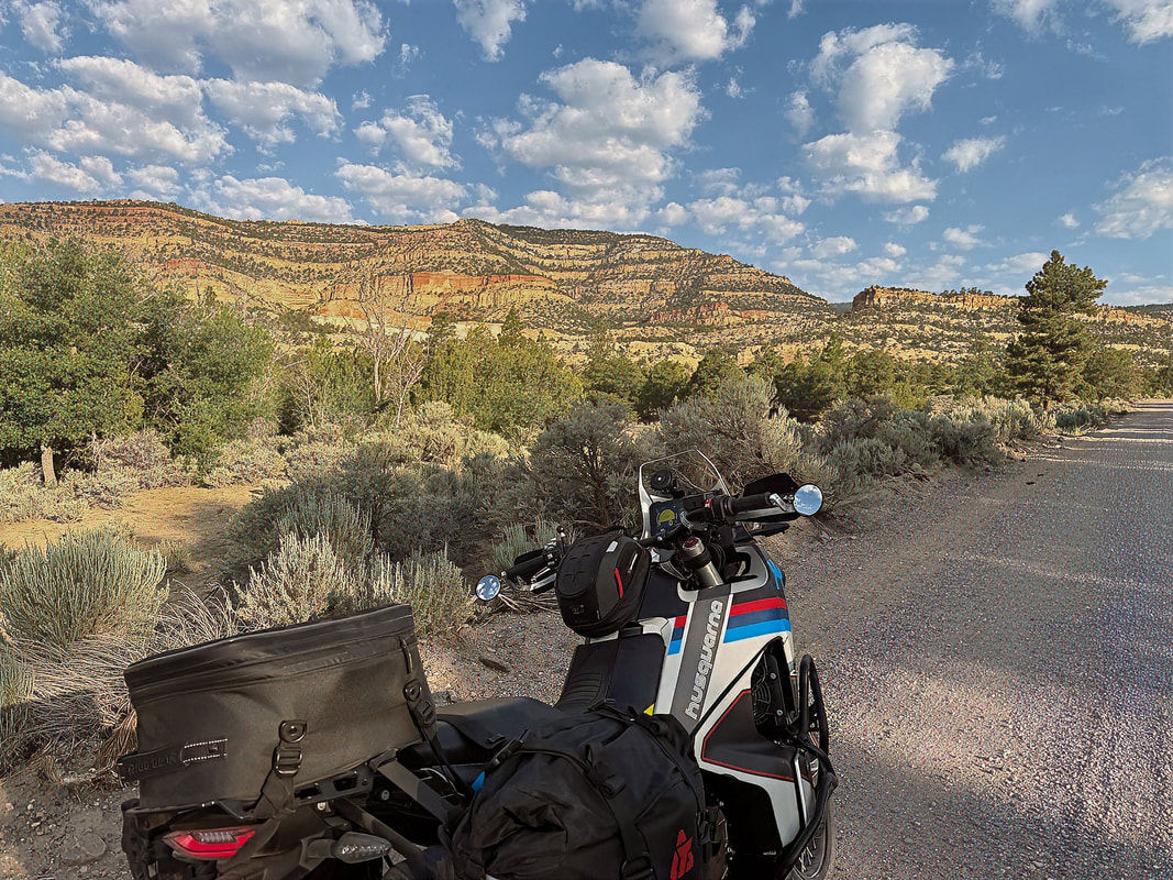
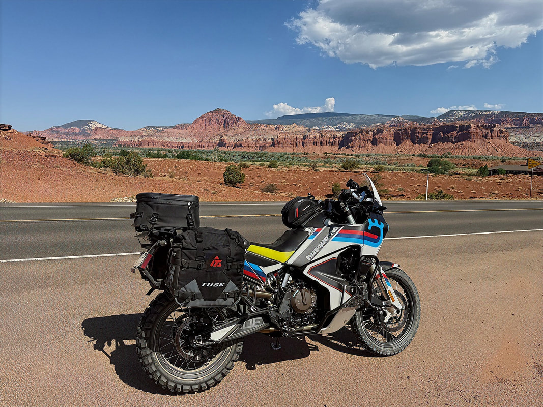
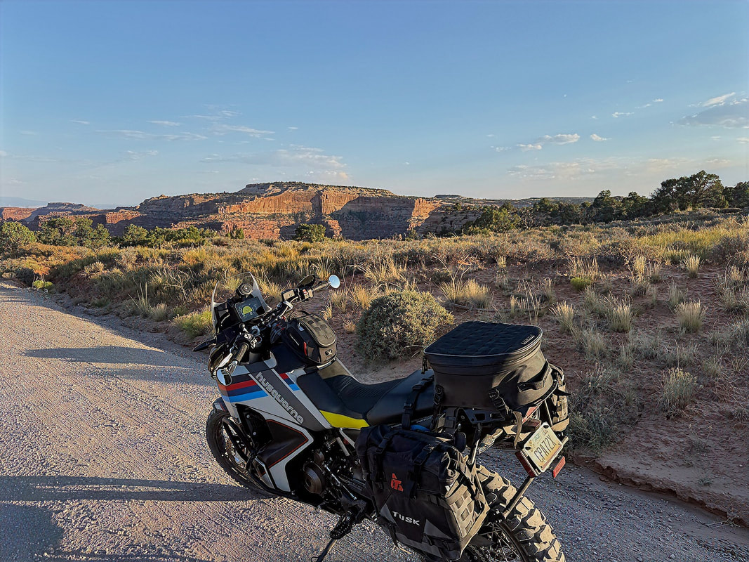
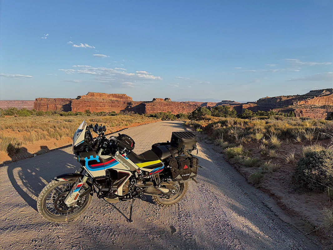
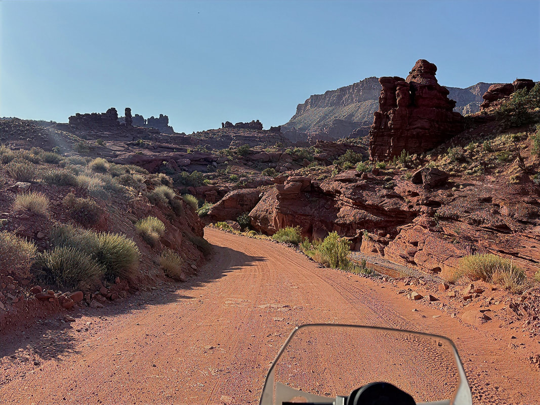
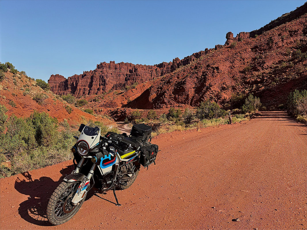
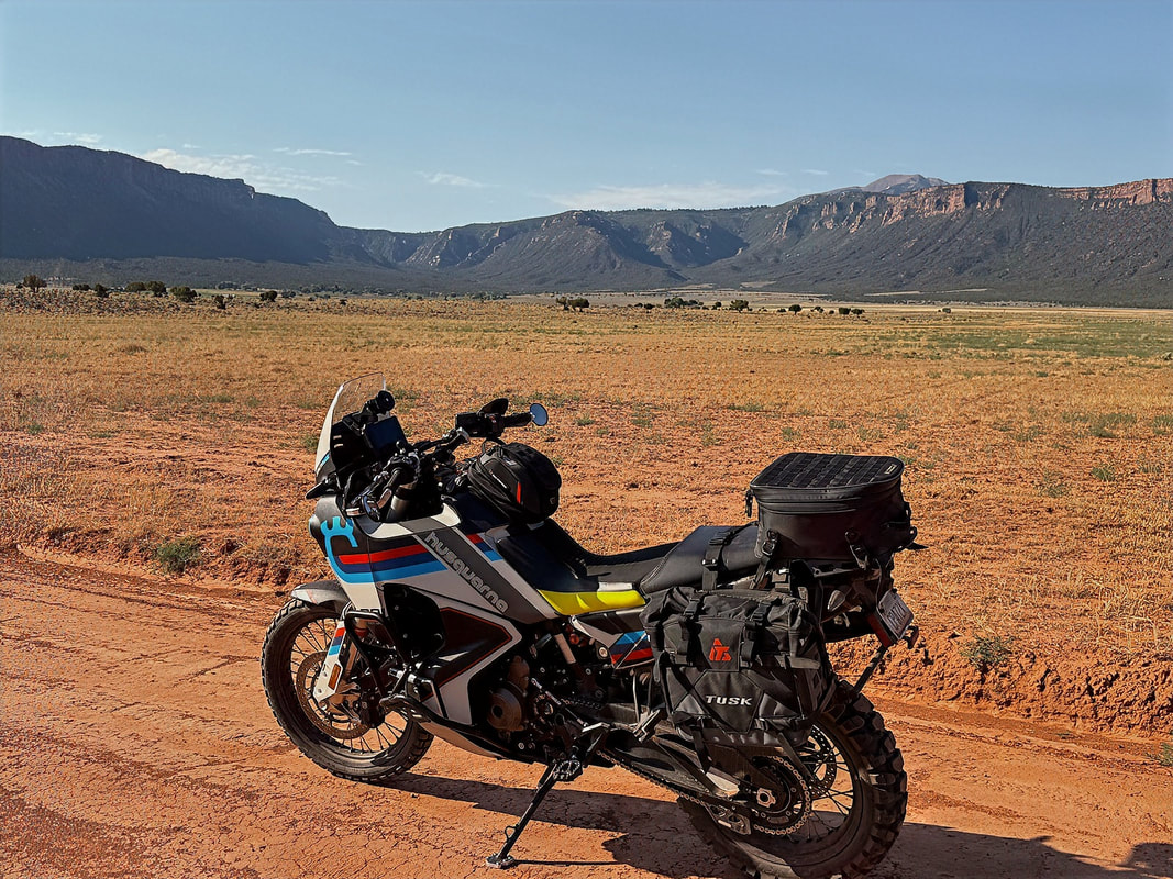
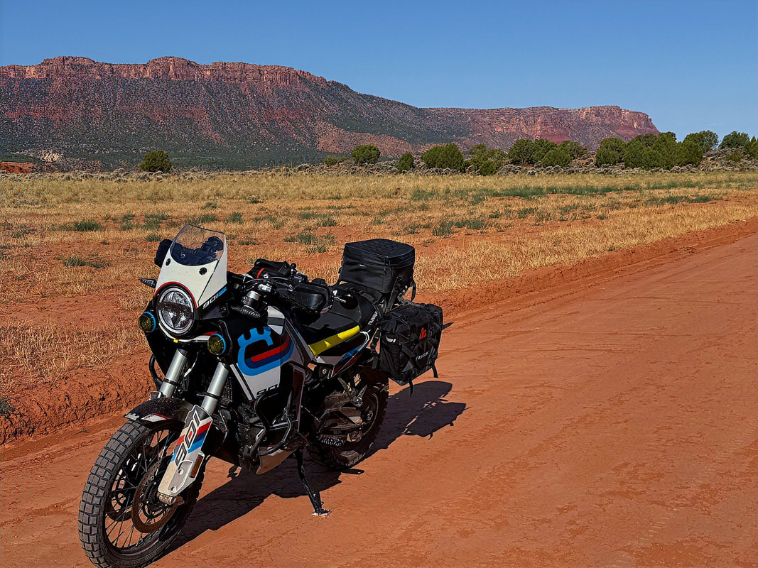
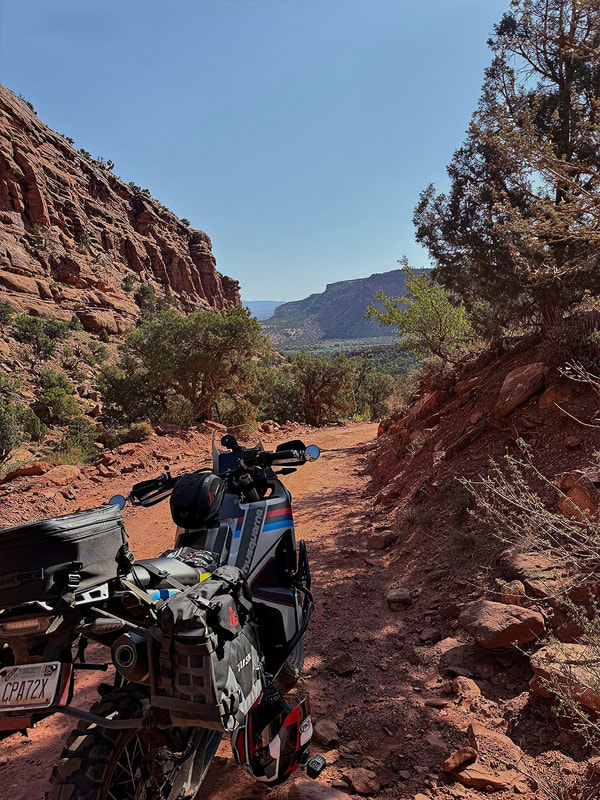
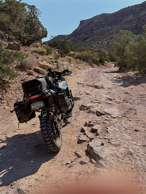
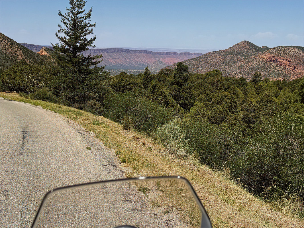
After reaching the top, pavement resumes and Hwy 261 takes me through the high desert. I link up to take Hwy 95 east, another scenic, remote stretch of road that does not disappoint. I'll eventually take Hwy 276 south. My next goal is to reach the Burr Trail, a roughly 67-mile road that traverses parts of Capitol Reef National Park and Grand Staircase-Escalante National Monument, providing remote riding through some of Utah's finest red rock country.
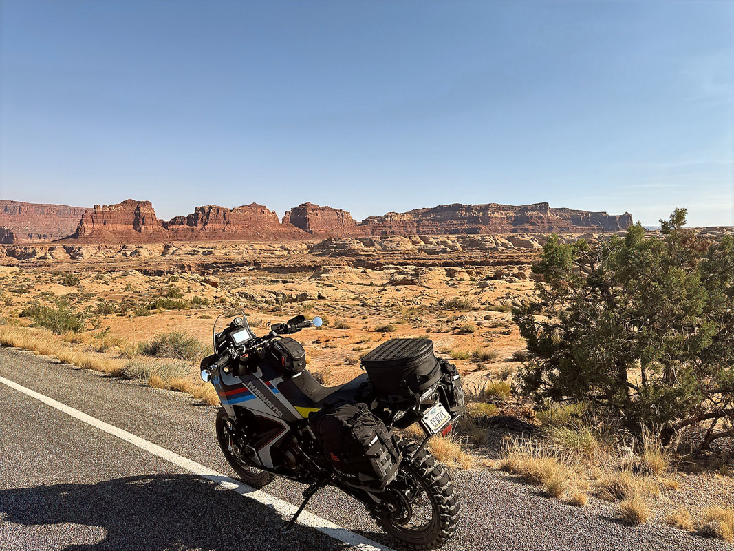
However, before reaching the Burr Trail, the scenery along 95 and 276 is endlessly photogenic, so I found myself stopping often - rocks, mesas, canyons, and wide-open spaces that make you feel like you're riding through a Western film set. The roads were nearly empty too. I probably saw a dozen vehicles all morning, all going the opposite direction, and just two other bikes. That solitude made the ride even more immersive.
However, before reaching the Burr Trail, the scenery along 95 and 276 is endlessly photogenic, so I found myself stopping often - rocks, mesas, canyons, and wide-open spaces that make you feel like you're riding through a Western film set. The roads were nearly empty too. I probably saw a dozen vehicles all morning, all going the opposite direction, and just two other bikes. That solitude made the ride even more immersive.
|
|
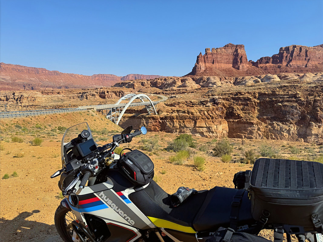
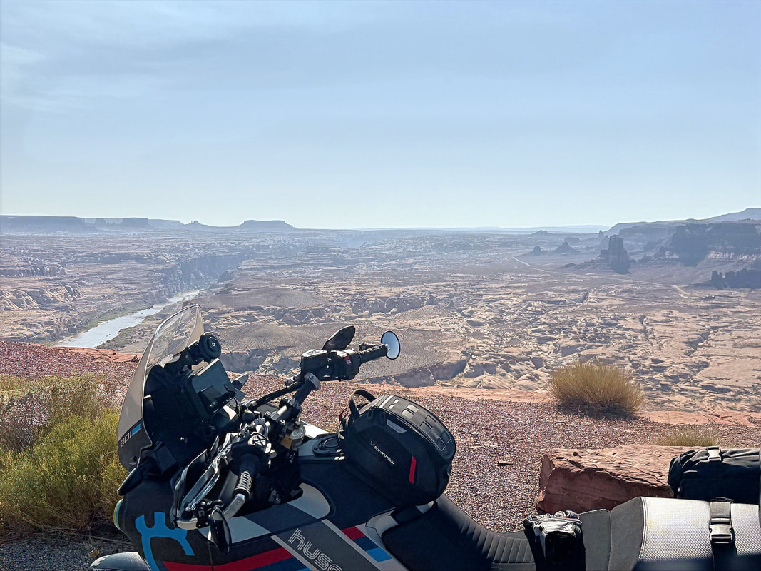
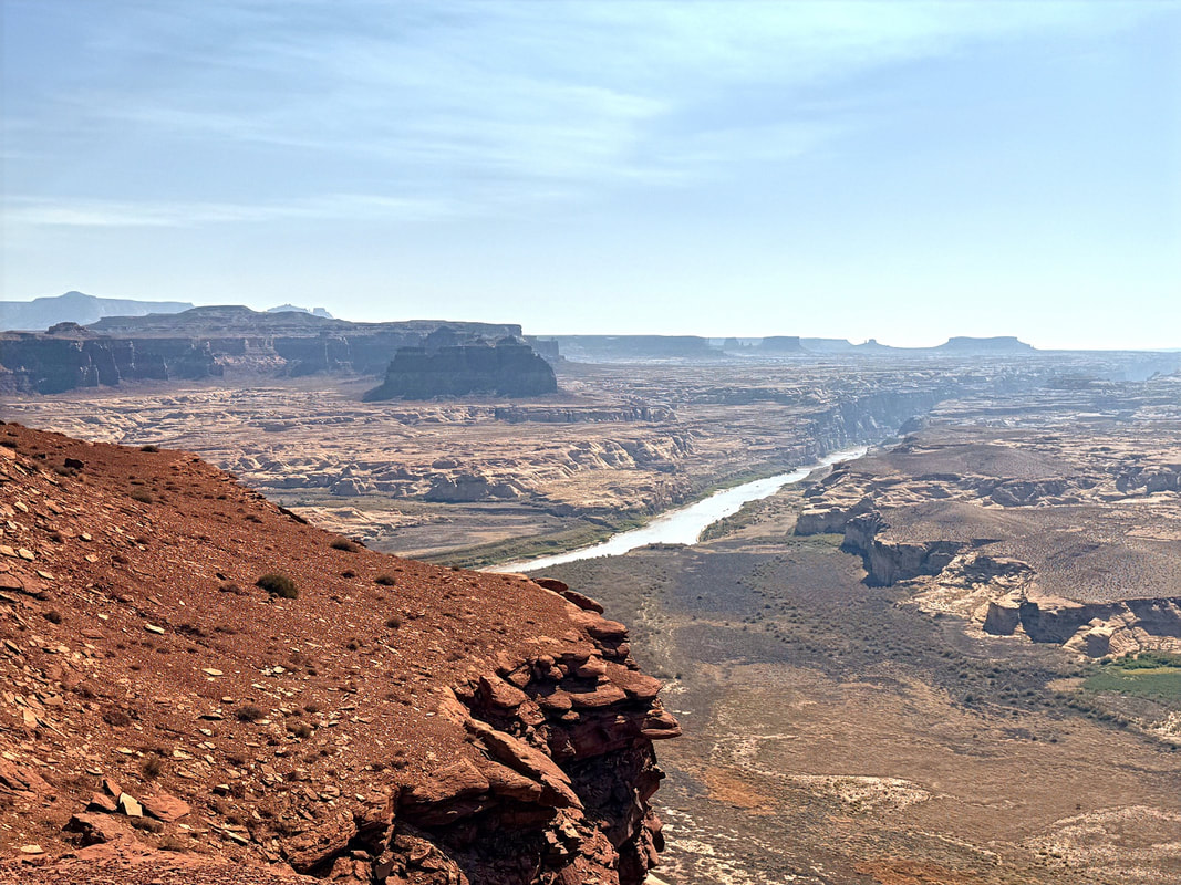
One highlight en route was crossing the Colorado River at Hite Crossing, a big, beautiful span in the middle of nowhere. This bridge is actually the only crossing of the Colorado between Moab and Page, which gives you an idea of how remote this part of Utah is.
After crossing the bridge at Hite, I stayed on Hwy 95 for another 18 miles or so before turning south onto Hwy 276.
|
|
My original plan had been to take Eggnog–Starr Road, a remote and scenic route that connects to the Burr Trail from the east, but I hadn’t seen a gas station since Mexican Hat, and I was getting low. Plus, I was in the mood for a cold soda and a quick break. So I skipped the Eggnog-Starr turnoff and continued south to Ticaboo, where I found a Sinclair station just beyond the town. I filled up the Norden and had the kind of gourmet road lunch only a gas station can offer: Famous Amos cookies and a Mountain Dew. Not exactly Michelin-rated, but it hit the spot.
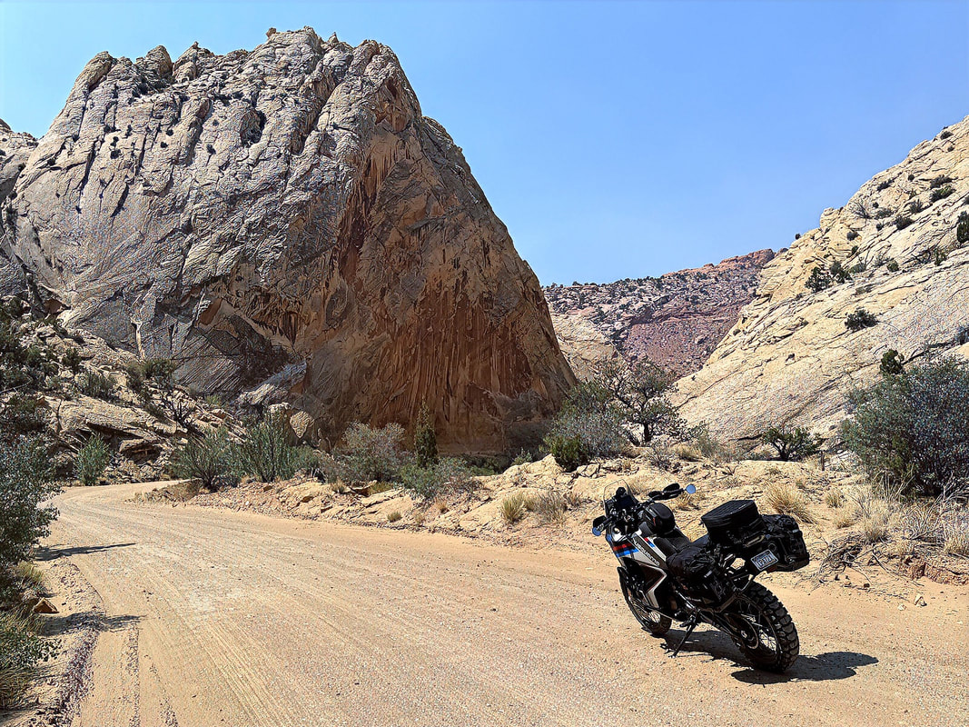
Fueled up in every sense, I continued south a few more miles until I hit the turnoff for the Burr Trail, the legendary route that winds its way through Capitol Reef National Park and the Grand Staircase–Escalante National Monument. It's about 67 miles long and a highlight for anyone riding through southern Utah.
The trail is named after John Atlantic Burr, a cattleman who settled in the area in the late 1800s and needed a way to move his herds between grazing areas and markets. In 1882, a pioneer named Josephine Catherine Chatterly Wood passed through here on her way to Bluff and described the region in her journal as “the most God-forsaken and wild-looking country that was ever traveled.”
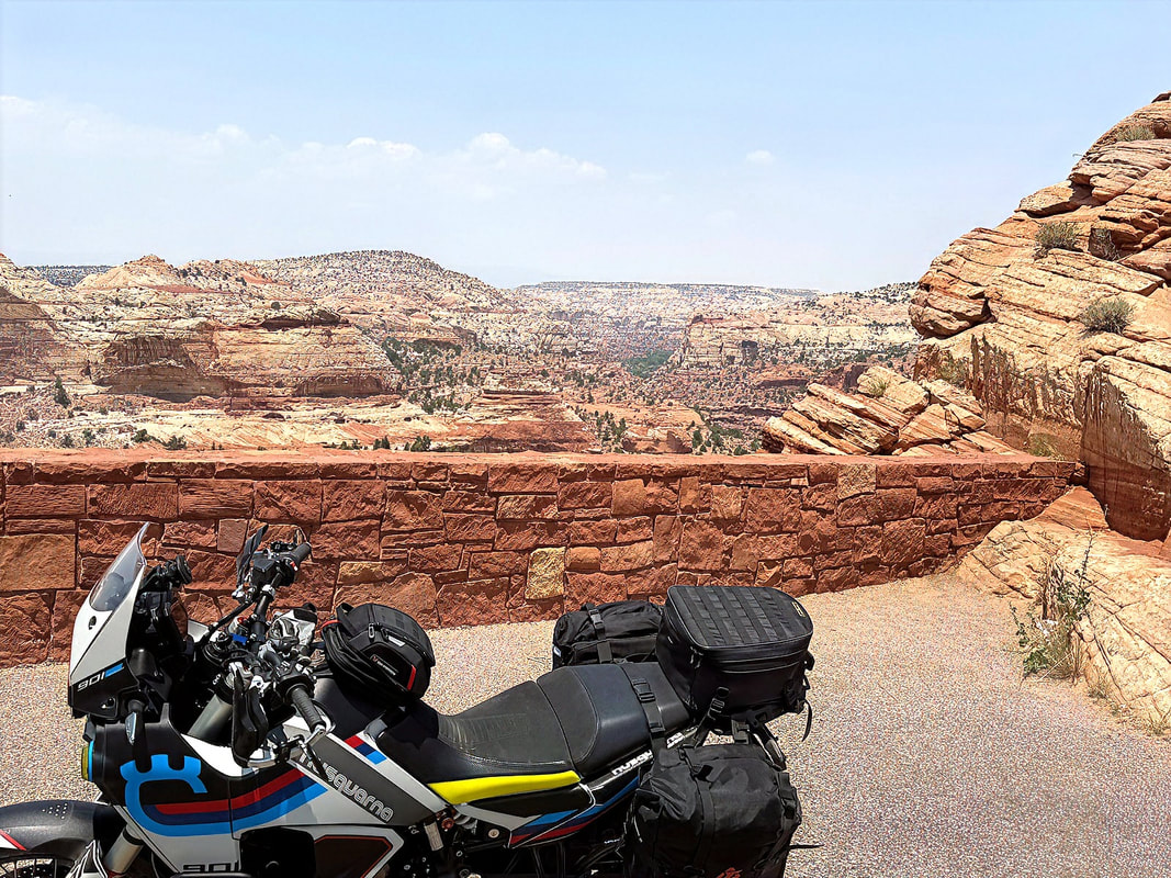
It’s still wild, but these days it’s more breathtaking than forsaken. The trail has undergone significant changes since then. Parts of the area were paved in the 1970s with the creation of the Glen Canyon National Recreation Area, and further paving followed in the 1990s. Today, the Burr Trail is fully paved except for an 8.5-mile unpaved section in Capitol Reef, which includes the famous Burr Trail switchbacks, a series of dramatic dirt zig-zags climbing up and over the Waterpocket Fold, a massive geologic uplift that defines the park.
Though mostly easy riding, the dirt section can become treacherous when wet. The red Utah clay turns slick and sticky quickly, and flash flooding at Bullfrog Creek and a few other low-lying areas can wash out even some paved sections. Fortunately, conditions were dry and near perfect when I rolled through.
Fueled up in every sense, I continued south a few more miles until I hit the turnoff for the Burr Trail, the legendary route that winds its way through Capitol Reef National Park and the Grand Staircase–Escalante National Monument. It's about 67 miles long and a highlight for anyone riding through southern Utah.
The trail is named after John Atlantic Burr, a cattleman who settled in the area in the late 1800s and needed a way to move his herds between grazing areas and markets. In 1882, a pioneer named Josephine Catherine Chatterly Wood passed through here on her way to Bluff and described the region in her journal as “the most God-forsaken and wild-looking country that was ever traveled.”
It’s still wild, but these days it’s more breathtaking than forsaken. The trail has undergone significant changes since then. Parts of the area were paved in the 1970s with the creation of the Glen Canyon National Recreation Area, and further paving followed in the 1990s. Today, the Burr Trail is fully paved except for an 8.5-mile unpaved section in Capitol Reef, which includes the famous Burr Trail switchbacks, a series of dramatic dirt zig-zags climbing up and over the Waterpocket Fold, a massive geologic uplift that defines the park.
Though mostly easy riding, the dirt section can become treacherous when wet. The red Utah clay turns slick and sticky quickly, and flash flooding at Bullfrog Creek and a few other low-lying areas can wash out even some paved sections. Fortunately, conditions were dry and near perfect when I rolled through.
|
|
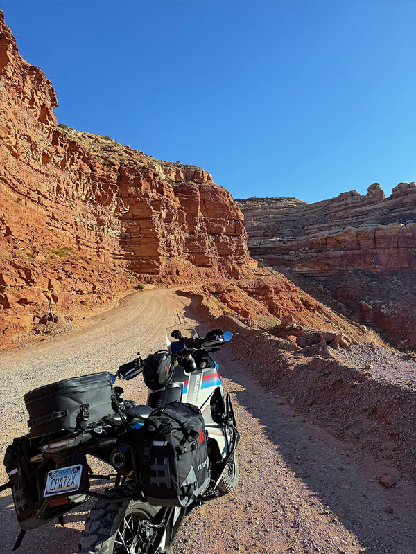
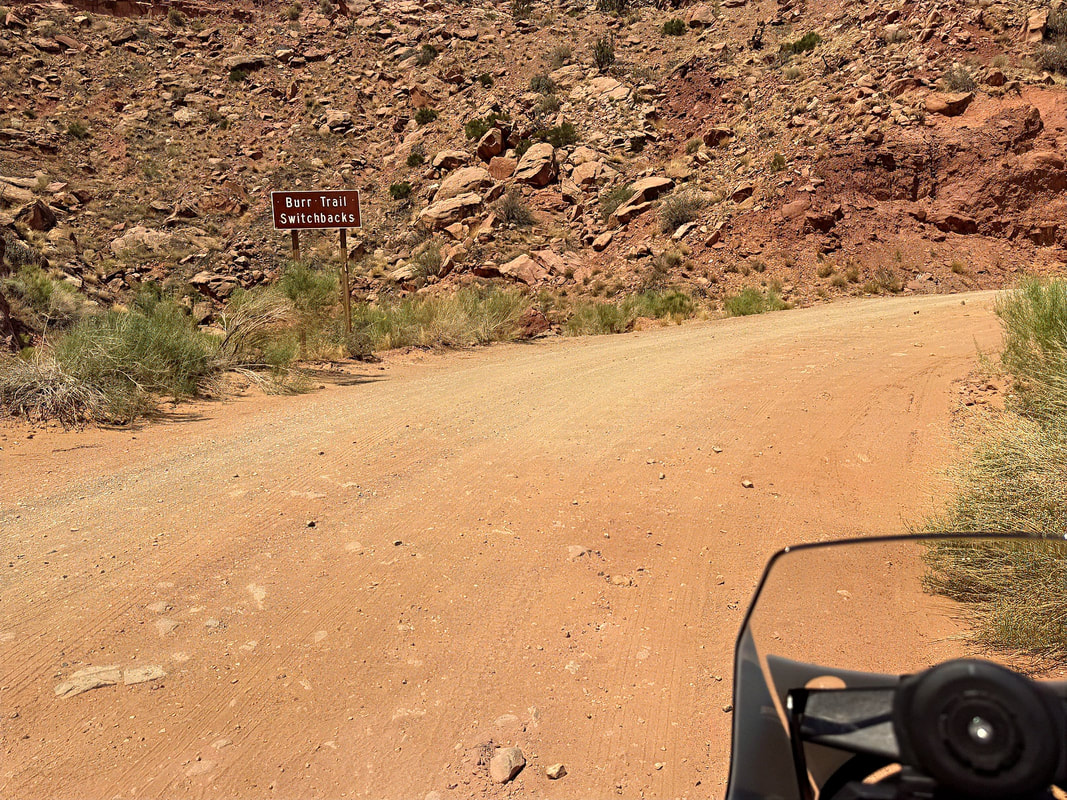
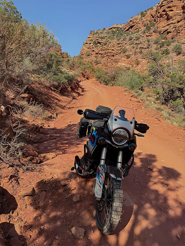
Once I hit the dirt, it was apparent how nasty this section could be in the wet. In some of the low-lying areas, deep, hardened ruts from previous vehicles were a reminder of what happens when people try to push through too soon after rain. I picked my way through the rougher bits and soon reached the sign marking the start of the switchbacks.
|
|
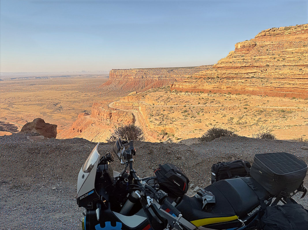
The switchbacks themselves were in good shape - nothing technical, just scenic - and the climb to the top was fun. After the summit, I hit a brutal stretch of washboard, until the road finally smoothed out and turned back to pavement as I descended toward Boulder, Utah.
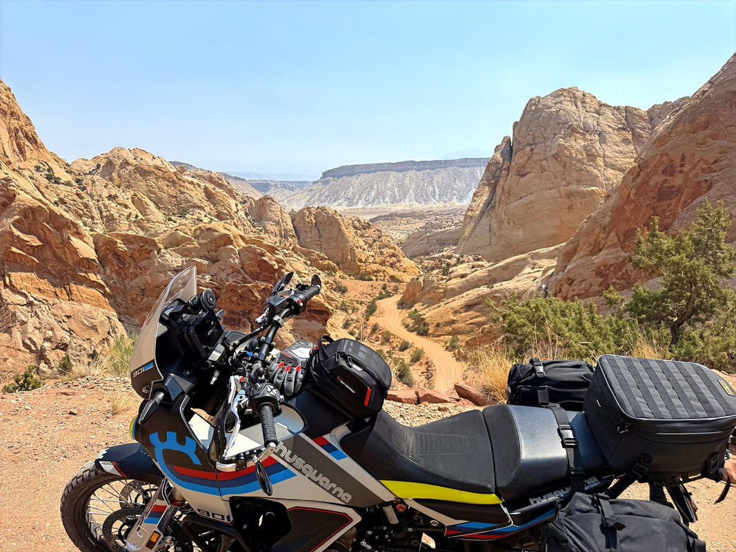

Again, I was struck by how empty the roads were. Aside from a single car at the top of the switchbacks about to descend, I didn’t see another vehicle, car or bike, along the entire length of the Burr Trail.
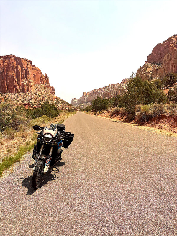
After reaching pavement again past the Burr Trail switchbacks, the scenery didn’t let up. The road winds through a stunning section known as Long Canyon, a narrow, winding stretch flanked by towering sandstone walls that seem to glow in the afternoon sun. It’s one of those places where you instinctively roll off the throttle just to take it all in.
After reaching pavement again past the Burr Trail switchbacks, the scenery didn’t let up. The road winds through a stunning section known as Long Canyon, a narrow, winding stretch flanked by towering sandstone walls that seem to glow in the afternoon sun. It’s one of those places where you instinctively roll off the throttle just to take it all in.
|
|
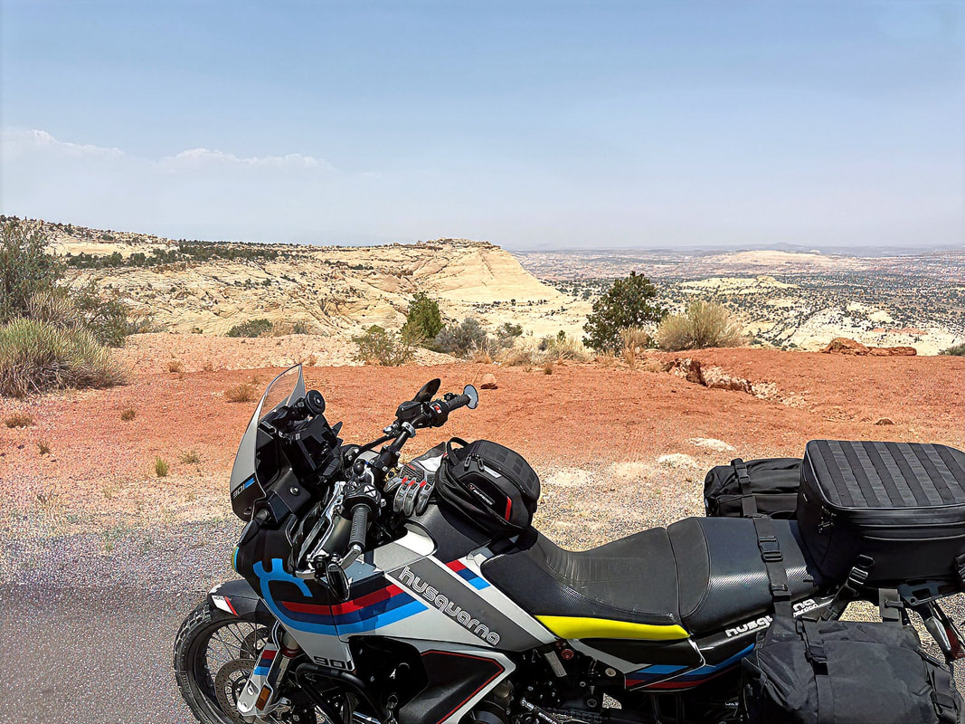
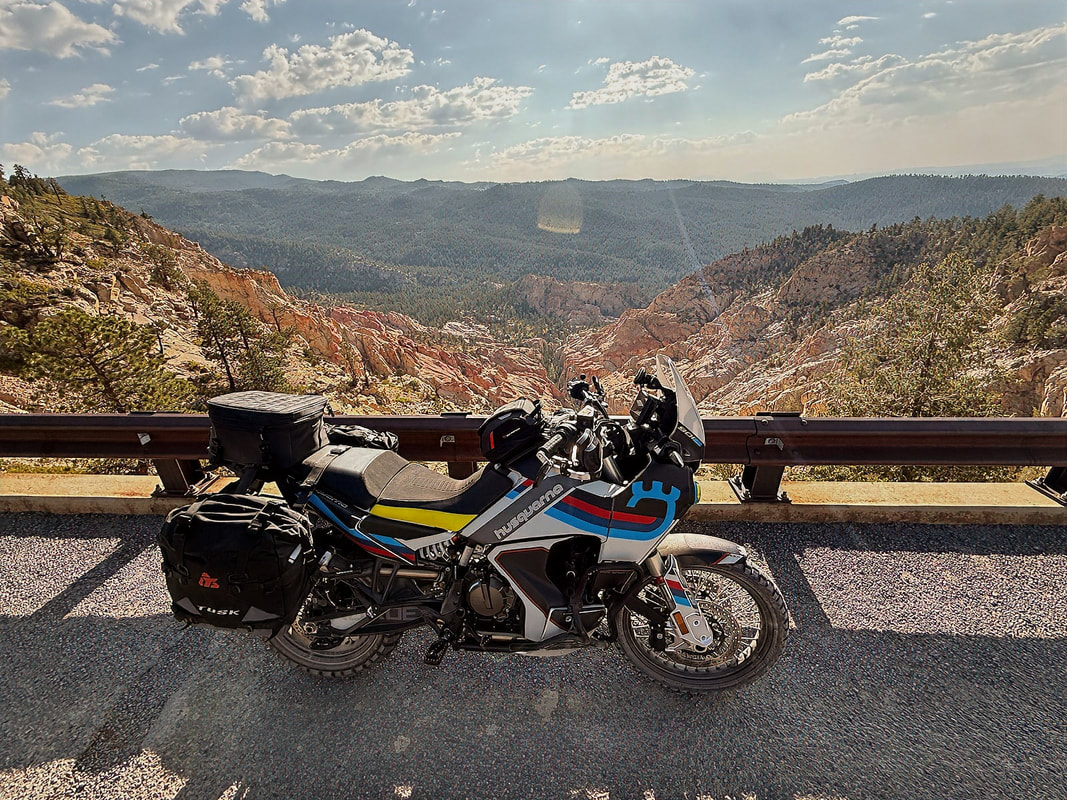
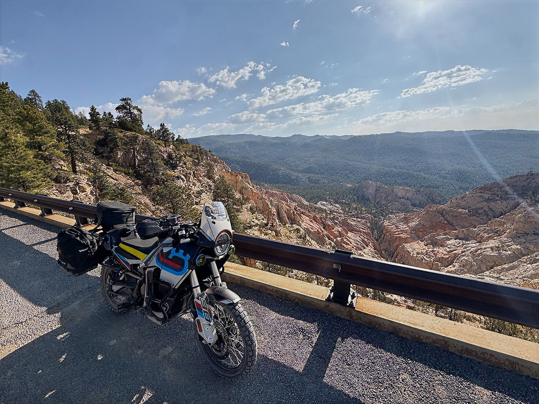
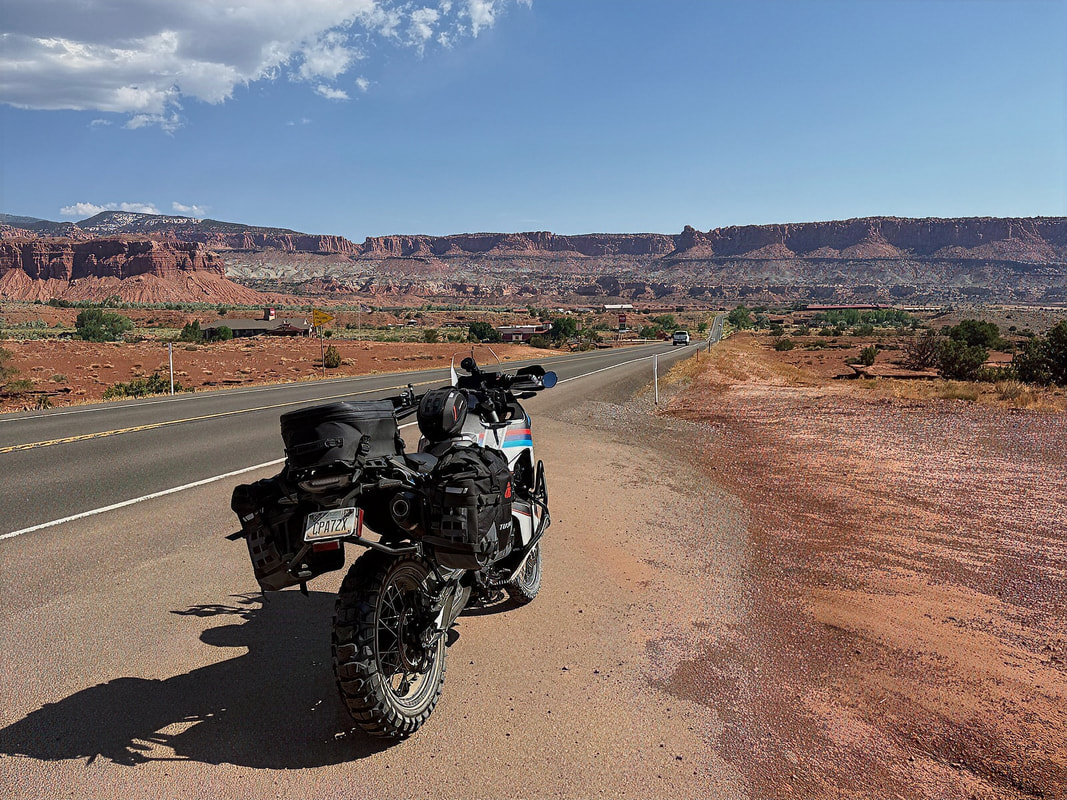
The Burr Trails ends in the town of Boulder, where I ate a quick lunch at the Burr Trail Grill. From Boulder, I picked up Hwy 12, which is one of the best paved roads in the state. It cuts through high desert, alpine forests, slickrock canyons, and offers nonstop views. The stretch into Escalante is especially beautiful, with flowing curves, big views, and that classic Utah mix of rock, sky, and space.
|
|
I rolled into Escalante late afternoon and checked into the Circle of Destination Motel, a simple, clean place with a friendly vibe. Even better, it’s right next to the 4th West Pub, where I wrapped up the day with a great burger, cold beer, and a little conversation with some fellow travelers passing through town.
A long but incredible day - gravel, red rock, remote backroads, and a full dose of classic Utah scenery.
A long but incredible day - gravel, red rock, remote backroads, and a full dose of classic Utah scenery.
Day 3 - Escalante to Moab (via Hells Backbone)
It’s Utah, so that means another day of absolutely epic riding. Today, I was especially looking forward to Hell’s Backbone Road, which starts right near the east end of Escalante. Despite the ominous name, the road itself is pretty mellow - it's mostly a well-graded gravel or dirt road, nothing too technical. But the views? Pure gold.
The ride would begin with Hell's Backbone before hitting the pavements on Hwys 12, 24, and I-70 before heading south on Hwy 191 to Moab.
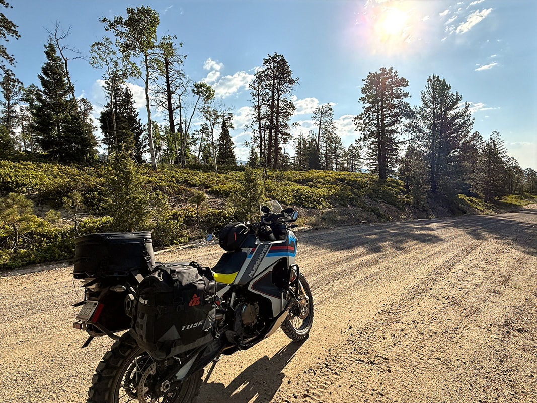
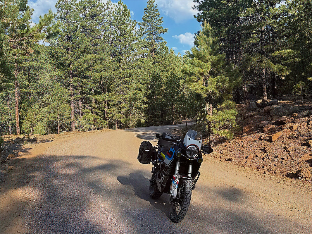
Hell’s Backbone Road was built in the 1930s by the Civilian Conservation Corps, and it climbs to over 9,000 feet as it winds through the Dixie National Forest, passing through tall pines and aspens. Eventually, the road crosses Hell’s Backbone Bridge, which spans a narrow hogsback ridge with steep drop-offs on both sides. It's one of those places that makes you stop and appreciate how wild and rugged this part of the country still is.
I left Escalante with a quick turn off Hwy 12 onto N 300 E, which becomes Pine Creek Road after about a mile. That eventually transitions into Hell’s Backbone Road. The first stretch is wide, flat, and gravel, easy cruising with big views of the Colorado Plateau off to the right. Soon, I'll be riding in the forest.
|
|
Before long, I was rolling across the iconic Hell’s Backbone Bridge. The views from both sides are dramatic - deep canyons and distant ridgelines in every direction. I pulled over for a few photos and just took a moment to enjoy the silence and solitude. As has been unusually typical on this ride, I did not see another vehicle between Escalante and Boulder.
|
|
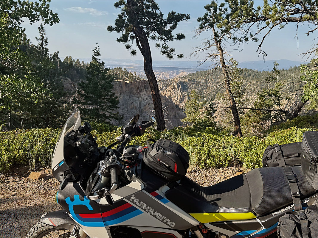
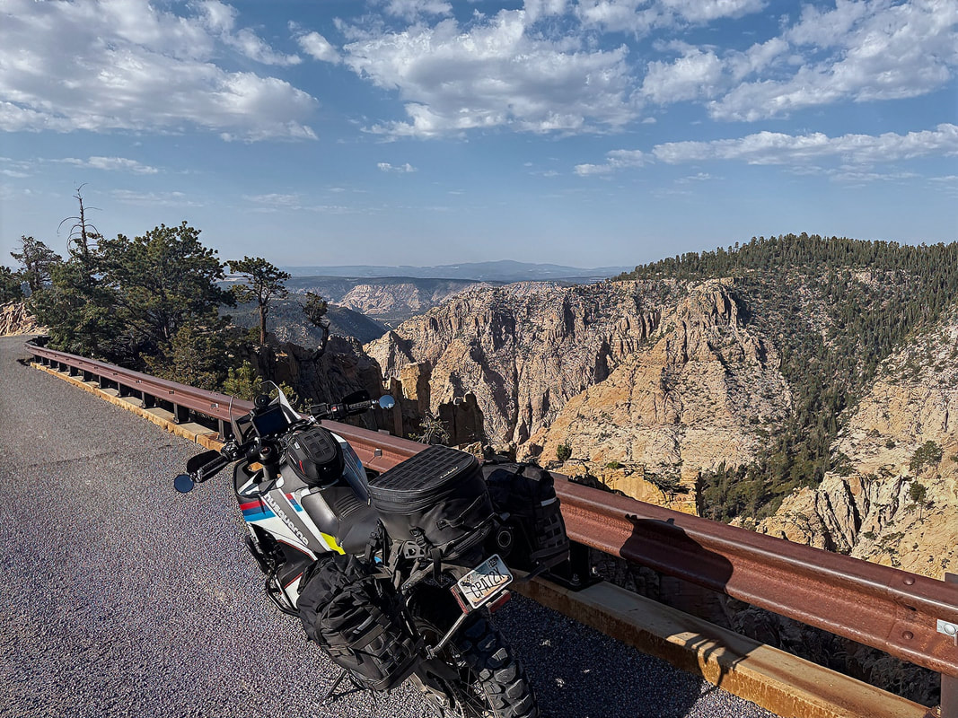
After the bridge, the road gradually descends back down to Hwy 12, rejoining just outside the town of Boulder. From there, Hwy 12 continues north, climbing again through the forest and offering sweeping views out toward Capitol Reef National Park to the east. This whole stretch is a highlight - smooth tarmac, flowing curves, and postcard views around every bend.
|
|
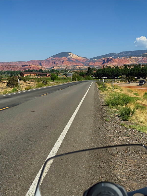
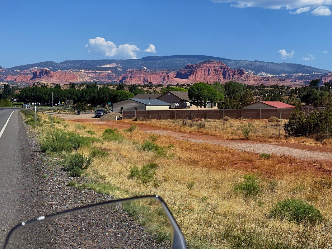
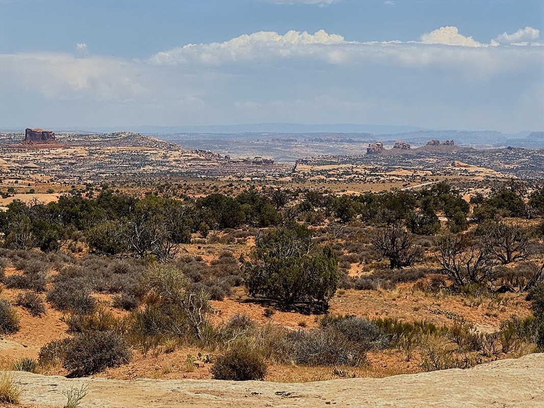
Eventually, Hwy 12 drops into the town of Torrey, where I picked up Hwy 24 heading east into Capitol Reef. Normally, I ride into the park itself, but today I stayed on the highway and soaked in the views from the road - massive cliffs, domes, and canyons in that unmistakable red-rock palette.
|
|
|
|
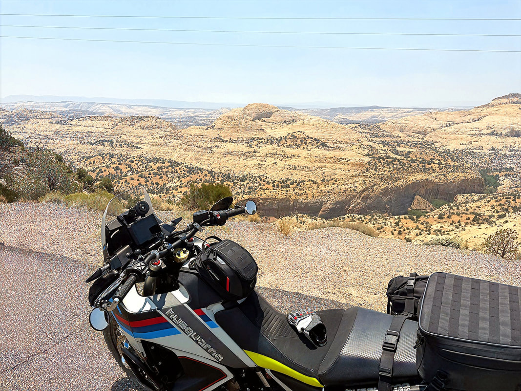
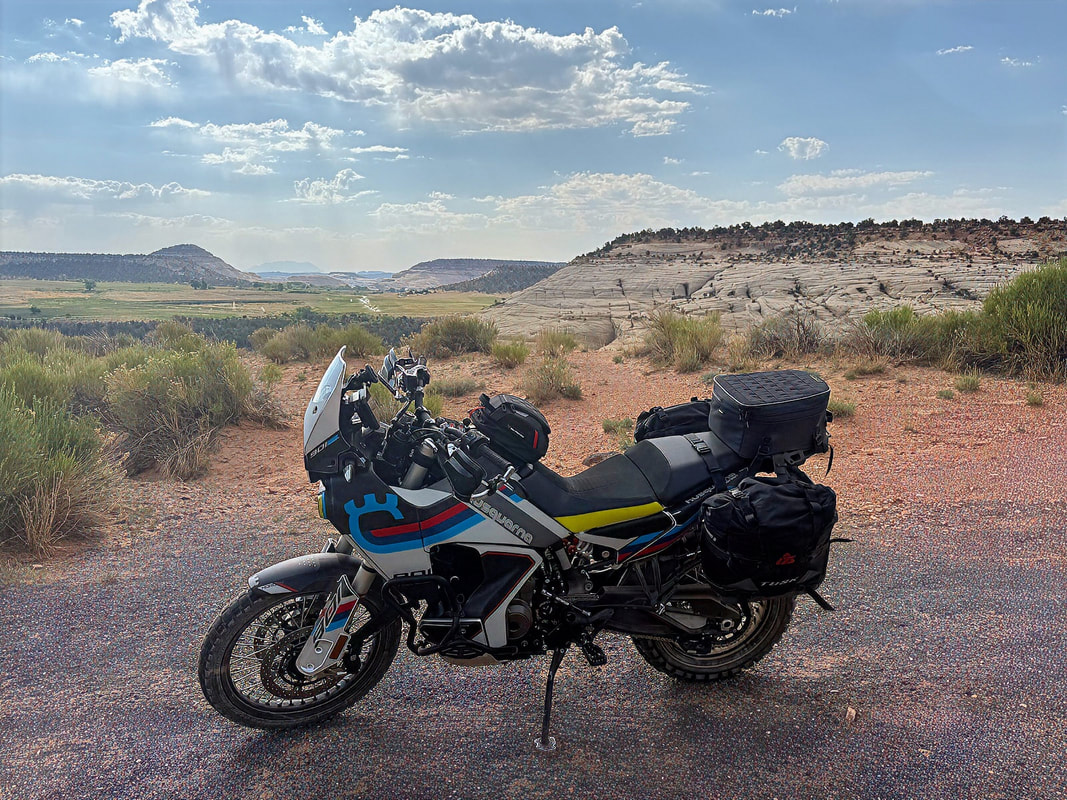
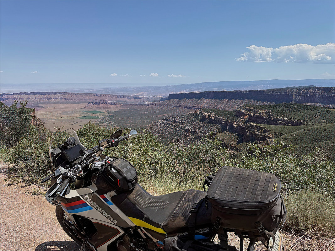
From Capitol Reef, I continued east on Hwy 24 to Hanksville, where I stopped for fuel, a cold drink, and a quick snack. Then it was north to I-70, eastbound for a short stretch, before dropping south on Hwy 191 toward Moab. I rolled into Moab around 2 PM, and the thermometer was reading 95°F - no surprise for late afternoon in June. With the sun high and no shade to be found, I decided to make a quick detour up Hwy 313, hoping to snap a few photos before checking into the Red Stone Inn.
|
|
But after just a few photos, it felt like I was baking in my gear. Time to cool off and refuel. I headed back into town, checked in, and unpacked the bag liners off the Norden. Then it was straight over to the Moab Brewery for a late lunch. I went with the pulled pork nachos and washed it down with a cold Moab Pilsner, the kind of simple perfection that hits just right after a long ride.
After lunch, I headed back to the room for some downtime. A little rest, a few emails, and just enough getting caught up on work issues to justify the ride later.
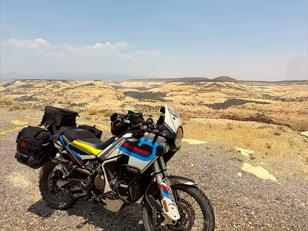
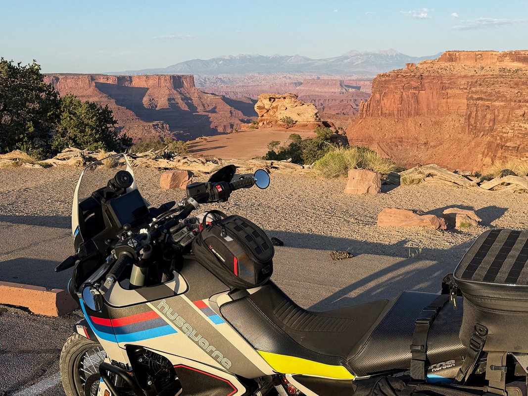
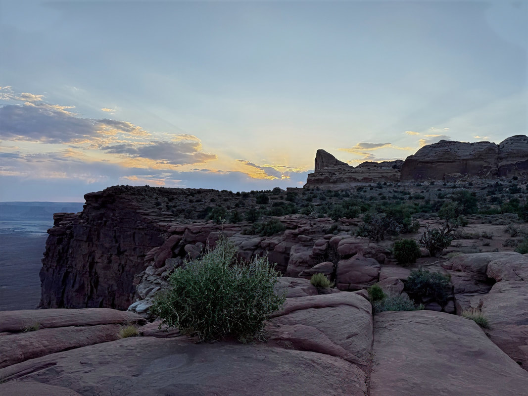
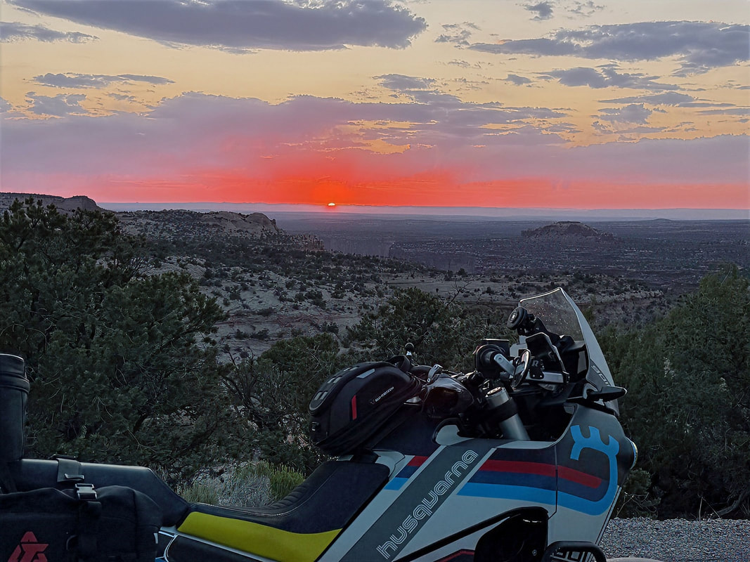
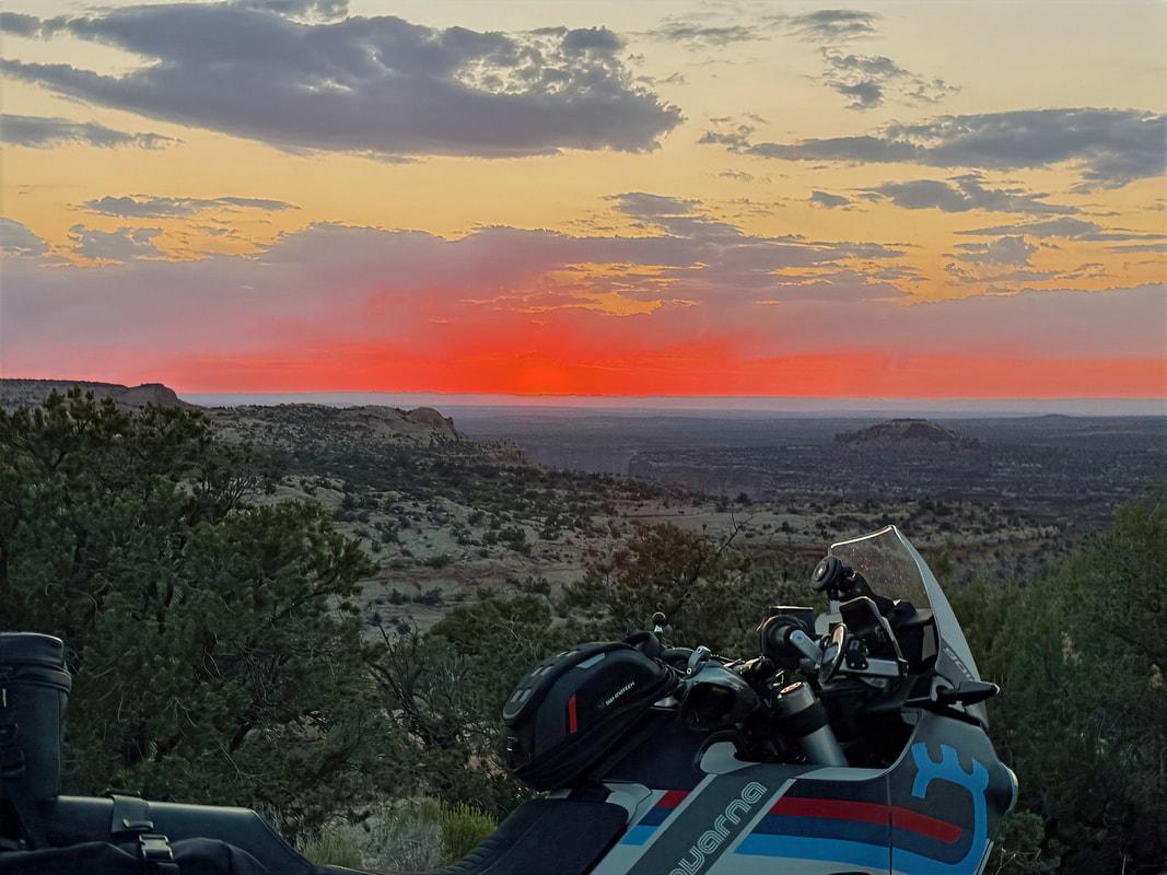
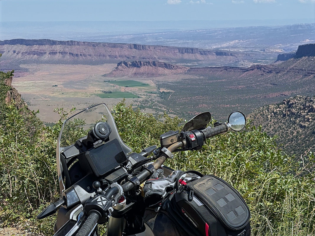
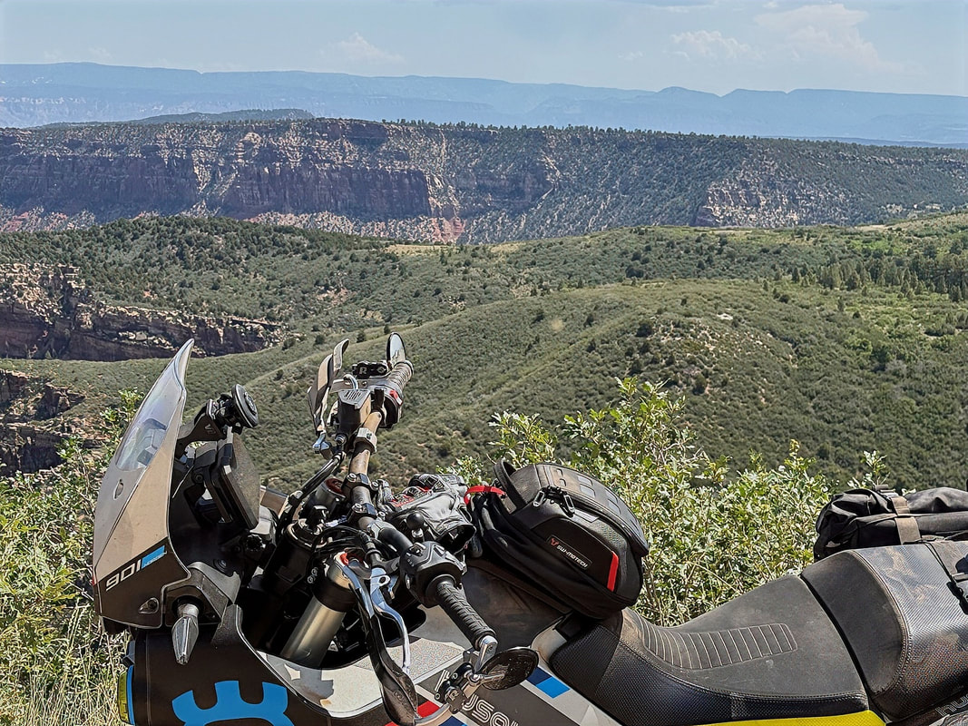
Around 7 PM, I was still full from lunch, but the temps had dropped a bit, and the light was getting good, so I decided to squeeze in a sunset ride. I headed back up Hwy 313 into Canyonlands National Park for more pictures.
After lunch, I headed back to the room for some downtime. A little rest, a few emails, and just enough getting caught up on work issues to justify the ride later.
Around 7 PM, I was still full from lunch, but the temps had dropped a bit, and the light was getting good, so I decided to squeeze in a sunset ride. I headed back up Hwy 313 into Canyonlands National Park for more pictures.
|
|
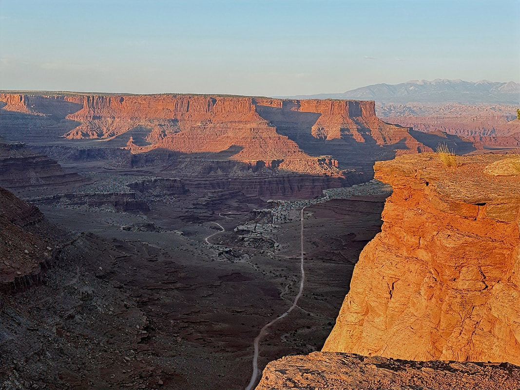
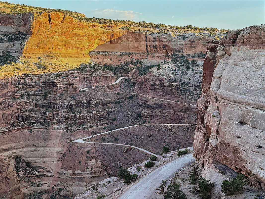
I visited the overlook area for the Shafer Trail. The sky was starting to shift into that golden-hour glow, and the canyons were casting long shadows.
|
|
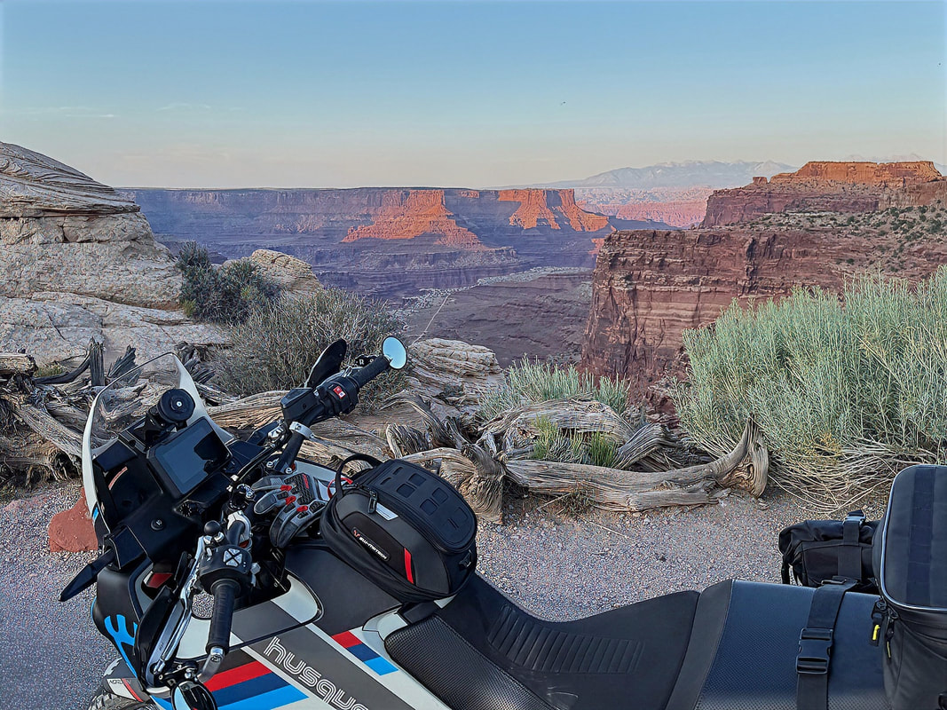
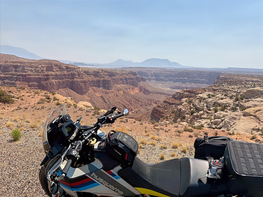
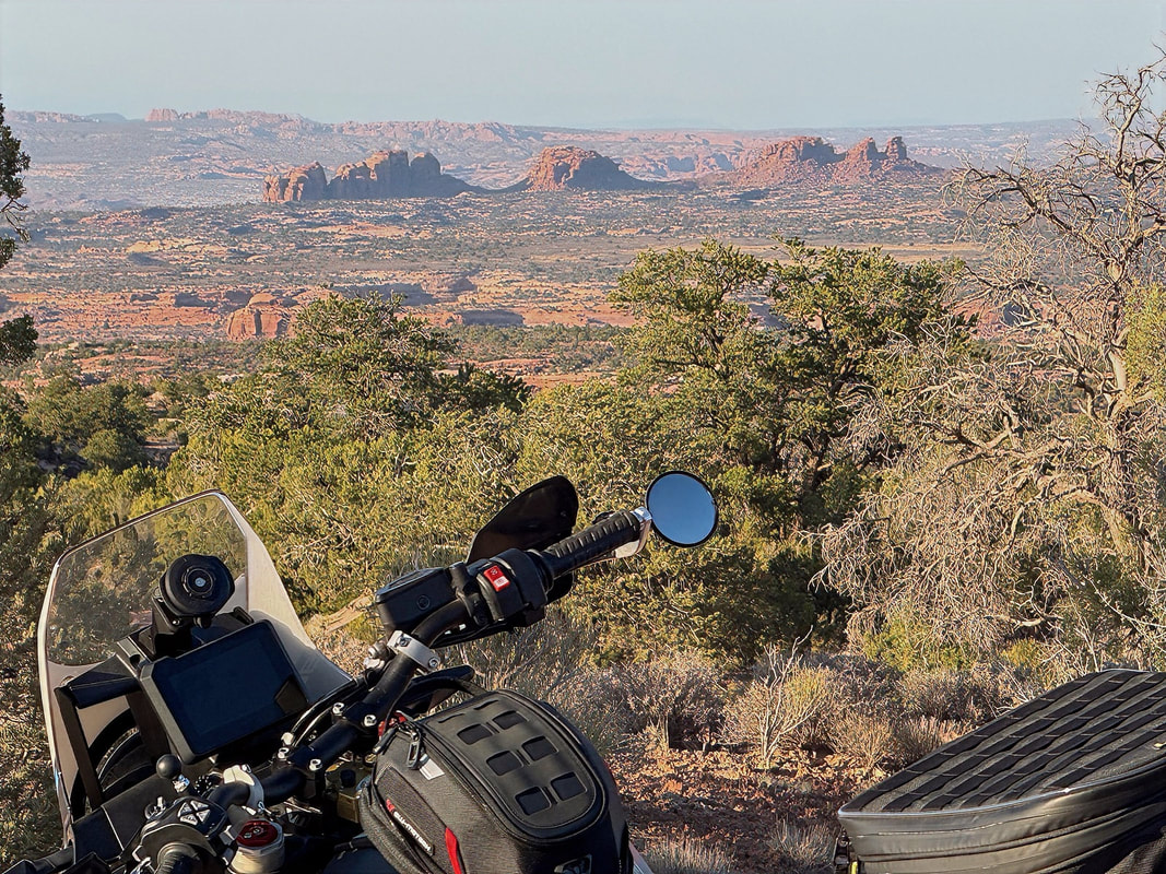
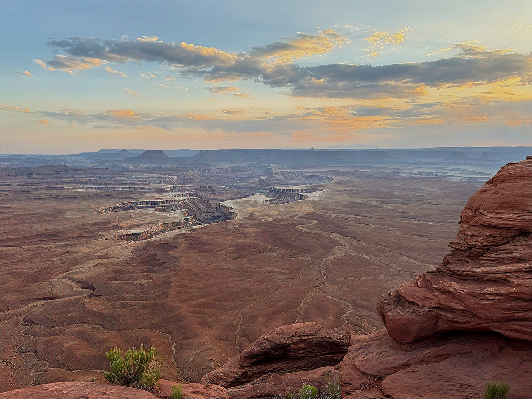
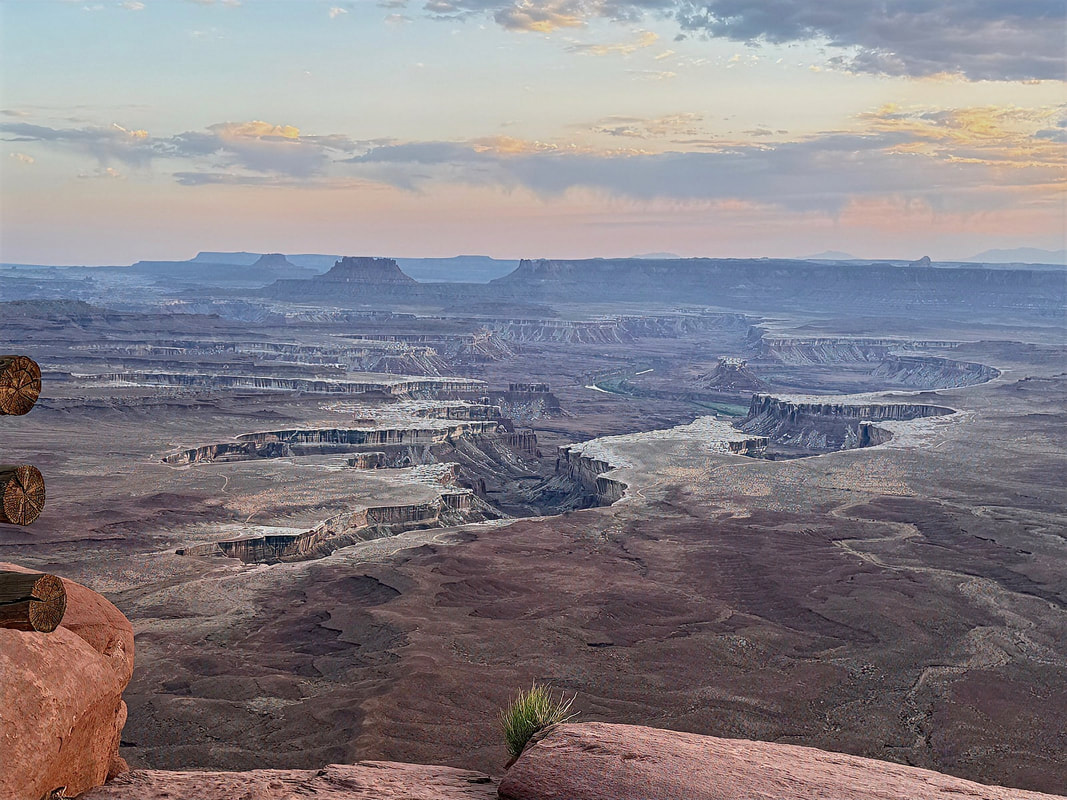
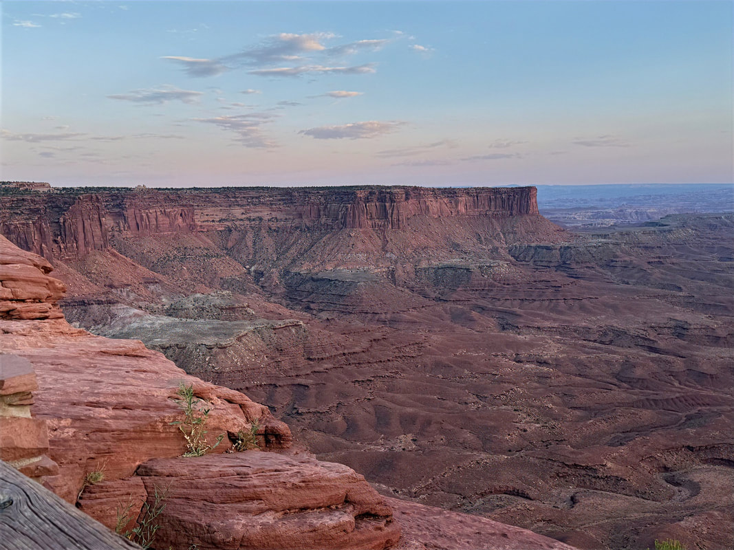
I hung out at the overlook for a bit, but dusk was beginning, and I decided to head towards the Green Valley Overlook, perched on the west rim of the Island in the Sky mesa.
The Green River Overlook is one of those spots that quietly humbles you. The view stretches across layered sandstone cliffs and deep canyons carved by the river, with the La Sal Mountains silhouetted in the distance. You can also make out the Shafer Trail at the edges of the canyon.
The Green River Overlook is one of those spots that quietly humbles you. The view stretches across layered sandstone cliffs and deep canyons carved by the river, with the La Sal Mountains silhouetted in the distance. You can also make out the Shafer Trail at the edges of the canyon.
|
|
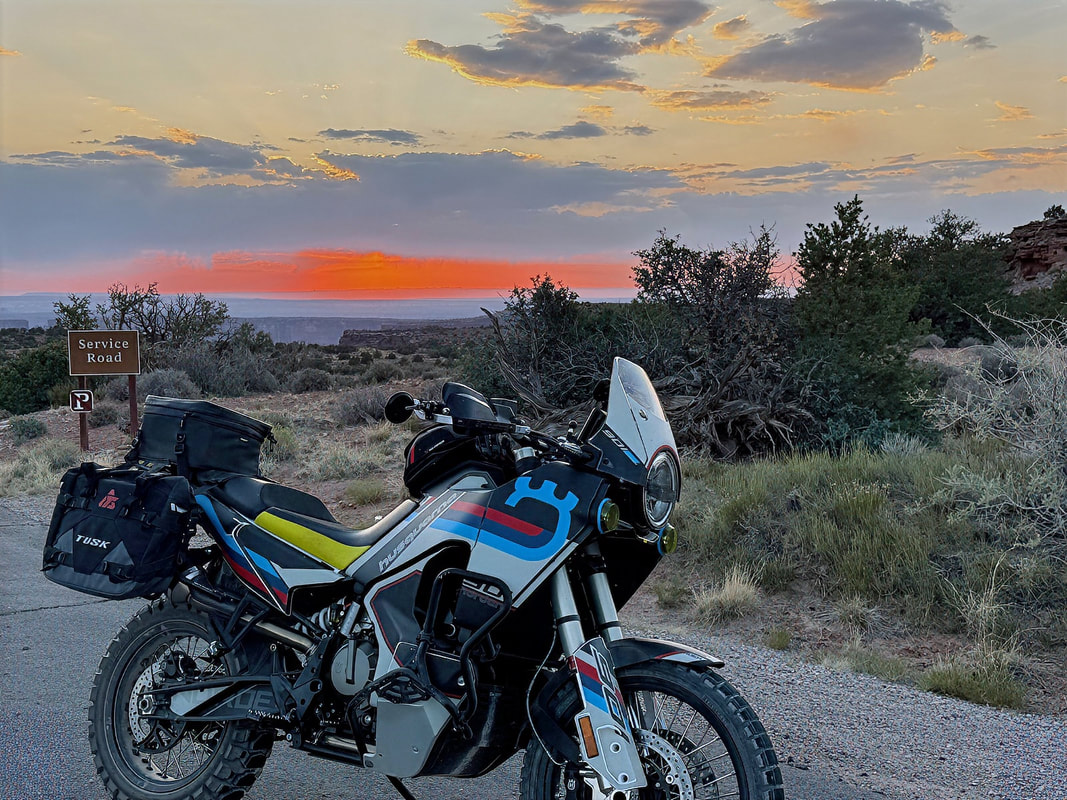
As the sun sank lower, I started riding back, stopping every few minutes to snap a photo, ride a bit farther, and do it all over again as the sun was setting. The sky lit up in bands of red and orange, a fitting end to an already spectacular day.
|
|
Day 4 - Moab
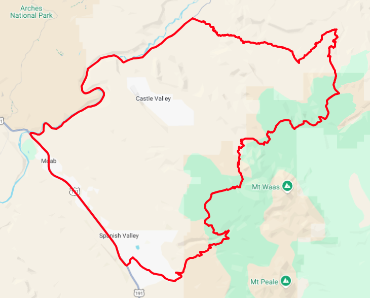
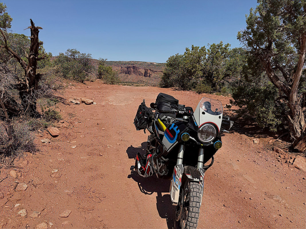
Today’s plan was to ride one of my favorite ADV loops in the Moab area - a roughly 90-mile mix of dirt and pavement that includes Onion Creek Trail, Hideout Canyon, Polar Mesa, and the La Sal Mountain Loop Road. It’s a fantastic route that delivers everything from canyon-carving to alpine forest views, all packed into a half-day ride.
Today’s plan was to ride one of my favorite ADV loops in the Moab area - a roughly 90-mile mix of dirt and pavement that includes Onion Creek Trail, Hideout Canyon, Polar Mesa, and the La Sal Mountain Loop Road. It’s a fantastic route that delivers everything from canyon-carving to alpine forest views, all packed into a half-day ride.
I’d thought about waking up early to catch sunrise photos in Arches National Park, but let’s be honest, I hit snooze and slept in. I finally got moving around 7:30 AM, and with temps expected to climb quickly, I decided to stick to just the Onion Creek Loop portion and aim to be back before the midday heat set in.
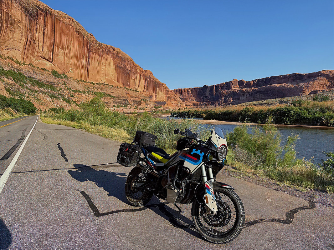
I headed north out of Moab on Hwy 191, then east onto Hwy 128, a stunning stretch that hugs the Colorado River as it winds through red rock cliffs. I couldn’t resist pulling over a couple of times to grab a few photos. No matter how many times I ride that road, it never gets old.
I headed north out of Moab on Hwy 191, then east onto Hwy 128, a stunning stretch that hugs the Colorado River as it winds through red rock cliffs. I couldn’t resist pulling over a couple of times to grab a few photos. No matter how many times I ride that road, it never gets old.
|
|
About 20 miles in, I reached the turnoff for the Onion Creek Trail. The trail starts out mellow - wide, flat, and graded for the first few miles. But soon enough, it dives into a twisting canyon carved by Onion Creek, and the scenery kicks up a notch (or ten). Almost immediately, you're surrounded by narrow canyon walls, wild rock formations, and vibrant red-and-orange cliff faces that glow in the morning light.
From that point on, the views are non-stop. You could literally stop after every corner to take photos in all directions, but if you did, you’d be there until sunset. Over the next 11 miles or so, the trail crosses Onion Creek more than 25 times, making for a fun and splashy ride. Nothing too deep, just enough to keep it interesting and cool off your boots a bit.
From that point on, the views are non-stop. You could literally stop after every corner to take photos in all directions, but if you did, you’d be there until sunset. Over the next 11 miles or so, the trail crosses Onion Creek more than 25 times, making for a fun and splashy ride. Nothing too deep, just enough to keep it interesting and cool off your boots a bit.
|
|
|
|
|
|
Eventually, the canyon opens up into the vast, grassy expanse of Fisher Valley, where the terrain flattens out. It’s a striking contrast to the tight canyon ride I've just finished. Much of the land here is part of Fisher Valley Ranch, a working cattle operation that’s protected by a conservation easement, so it remains undeveloped and incredibly scenic.
|
|
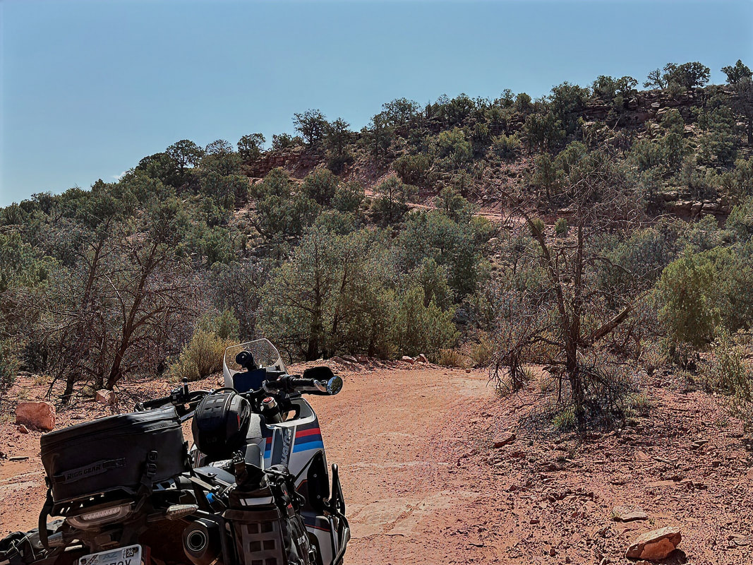
At the end of Onion Creek Trail, I picked up the Hideout Canyon Trail, which climbs gradually to the northwest for about five miles. As the elevation increases, the terrain starts to shift—less red rock and more high-desert scrub, with distant views opening up behind you. After cresting a rise, the trail descends into Hideout Canyon, a rugged and remote area steeped in Wild West lore. According to local legend, Butch Cassidy and the Wild Bunch used this canyon as a hideout back in the day, and once you're in there, it’s easy to see why. The canyon is isolated, with high walls and twisting terrain that would’ve made it easy to disappear from the law. Despite its outlaw history and rough-looking surroundings, the trail itself is only moderately challenging—definitely manageable on an ADV bike or in a high-clearance Jeep. There are a few rocky sections and mild ledge steps, but nothing too technical as long as you pick your lines.
From the ridge, the trail continues generally south for about eight miles, meandering through scenic backcountry with a mix of short climbs and descents. There are a few fun spots with embedded rock and loose gravel, even one short section of sand, but nothing that felt sketchy. Just enough to keep things interesting.
From the ridge, the trail continues generally south for about eight miles, meandering through scenic backcountry with a mix of short climbs and descents. There are a few fun spots with embedded rock and loose gravel, even one short section of sand, but nothing that felt sketchy. Just enough to keep things interesting.
|
|
Somewhere along Hideout Canyon Road, I pulled over for a quick break - time for a snack and to down a couple of bottles of water I’d stashed in my pannier bag. It was really starting to heat up by this point, 95°F and still climbing, and the sun was baking everything that wasn’t in motion. Along Hideout Canyon Road, I passed a jeep going in the other direction that was the only vehicle I saw between the beginning of Onion Creek Road and just a few miles before reaching Hwy 191 near Moab.
I continued to Polar Mesa Road, a smoother, easier stretch that starts curving southwest, slowly working its way back toward Moab.
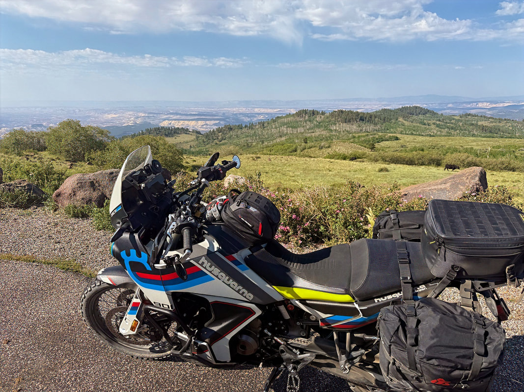
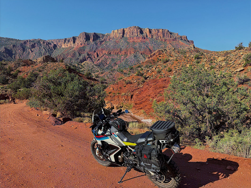
The terrain begins to shift again as the road gains elevation, eventually connecting with the La Sal Mountain Loop Road. The La Sal Loop is always a favorite. It climbs through aspen groves, pine stands, and open ridgelines, offering sweeping views back toward Castle Valley, Fisher Towers, and the red rock mesas below. The elevation offers a bit of relief from the heat, and the twisting pavement through the high country is a perfect way to wind down the ride.
|
|
I made it back to Moab around 12:30 PM, just in time to beat the worst of the afternoon heat. After a long, dusty morning, a shower felt pretty amazing. I wandered across the street for lunch at the Moab Grill, then headed back to the room for a short nap.
The rest of the afternoon was low-key: checked emails, wrapped up a work report, and caught up on a few loose ends. Later in the evening, I walked over to Blu Pig BBQ for dinner—solid brisket, good beer selection, and a relaxed vibe to cap off a great day.
The rest of the afternoon was low-key: checked emails, wrapped up a work report, and caught up on a few loose ends. Later in the evening, I walked over to Blu Pig BBQ for dinner—solid brisket, good beer selection, and a relaxed vibe to cap off a great day.
Day 5 - Moab to Mexican Hat
Today’s ride was about heading back to Mexican Hat, but I decided to stretch it out a bit with a detour into Colorado - because why not add another state to the trip?
Today’s ride was about heading back to Mexican Hat, but I decided to stretch it out a bit with a detour into Colorado - because why not add another state to the trip?
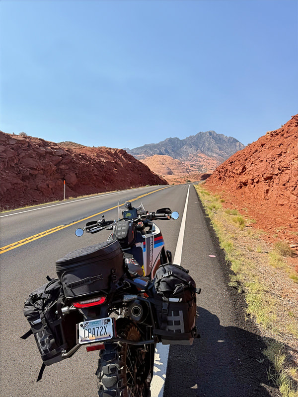
I left Moab heading south on Hwy 191, then turned east on Hwy 46, which becomes Hwy 90 just after crossing into Colorado. From there, I followed Hwy 141 south, passing through the small towns of Naturita, Slick Rock, and Egnar - quiet roads, incredible scenery, and zero traffic. Eventually, I picked up Hwy 491 west, which brought me back into Utah and reconnected with Hwy 191 south.
Just past Bluff, I stayed straight onto Hwy 163, which would take me toward the real highlight of today's ride - the Valley of the Gods.
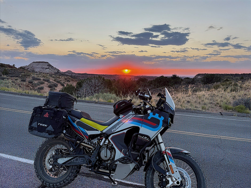
Along the way, I grabbed a few quick photos around the Utah–Colorado border, where the landscape starts shifting dramatically—classic high desert transitioning into canyon country. But for most of the ride, I just enjoyed the flow of the open road. No rush, no crowds, just a relaxed cruise through beautiful country with some tunes playing in my earbuds.
Just past Bluff, I stayed straight onto Hwy 163, which would take me toward the real highlight of today's ride - the Valley of the Gods.
Along the way, I grabbed a few quick photos around the Utah–Colorado border, where the landscape starts shifting dramatically—classic high desert transitioning into canyon country. But for most of the ride, I just enjoyed the flow of the open road. No rush, no crowds, just a relaxed cruise through beautiful country with some tunes playing in my earbuds.

I made a stop in Monticello for fuel, and later had lunch at the Cedar Shack Cafe in Bluff - a plate of chicken quesadillas and an iced tea hit the spot.
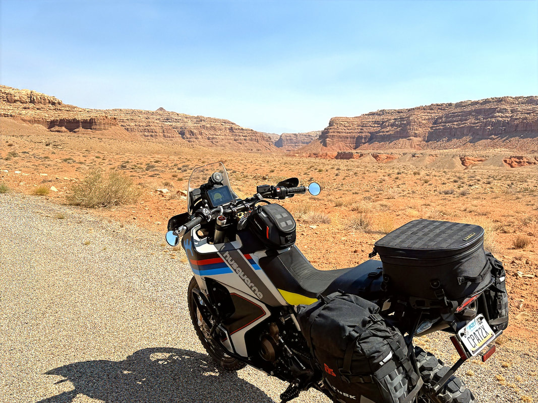
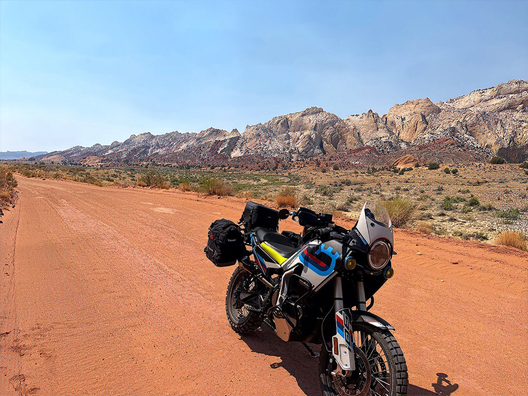
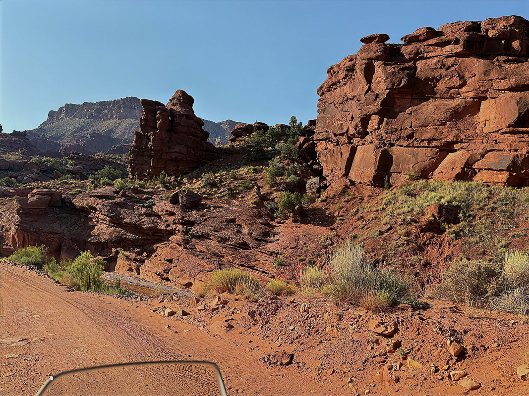
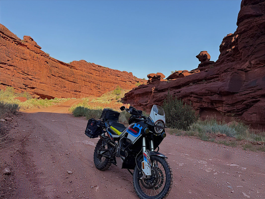
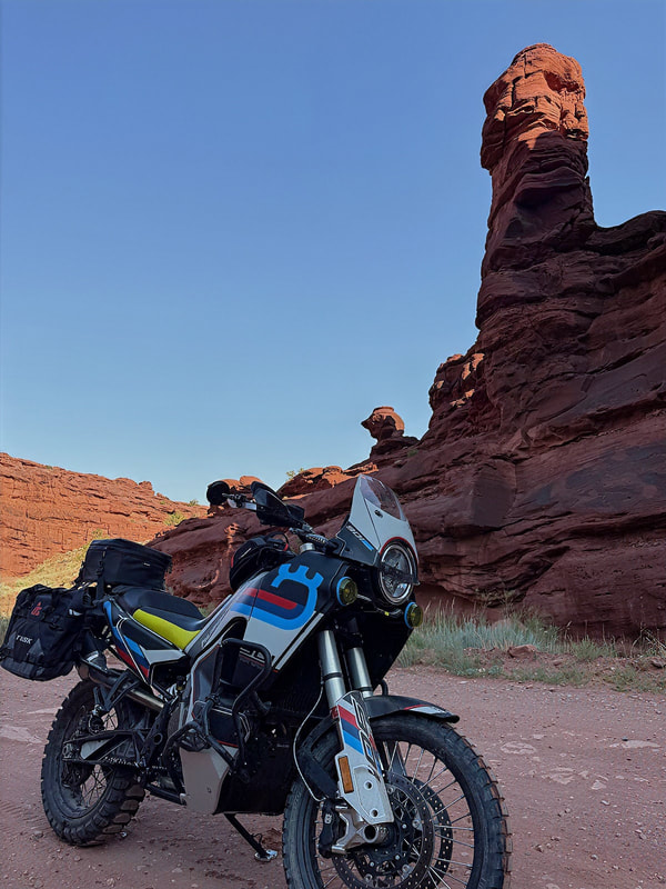
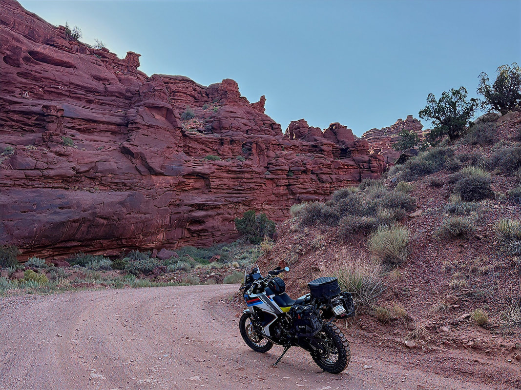
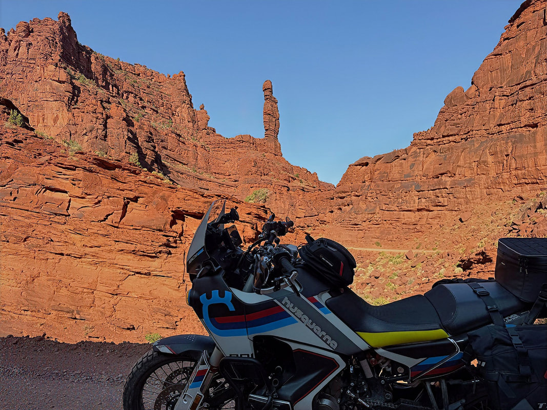
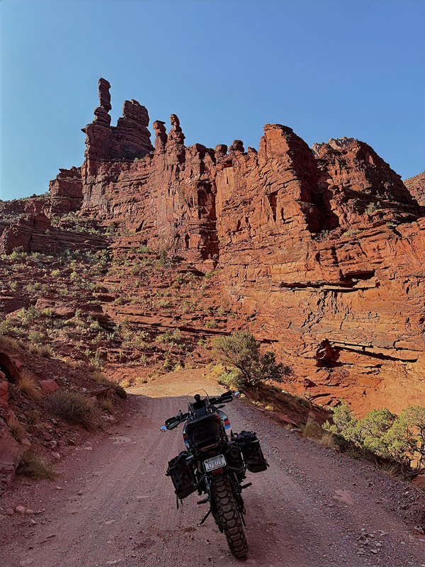
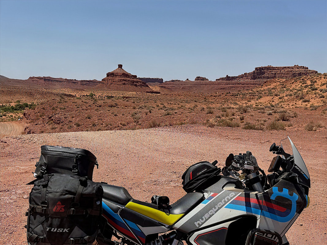
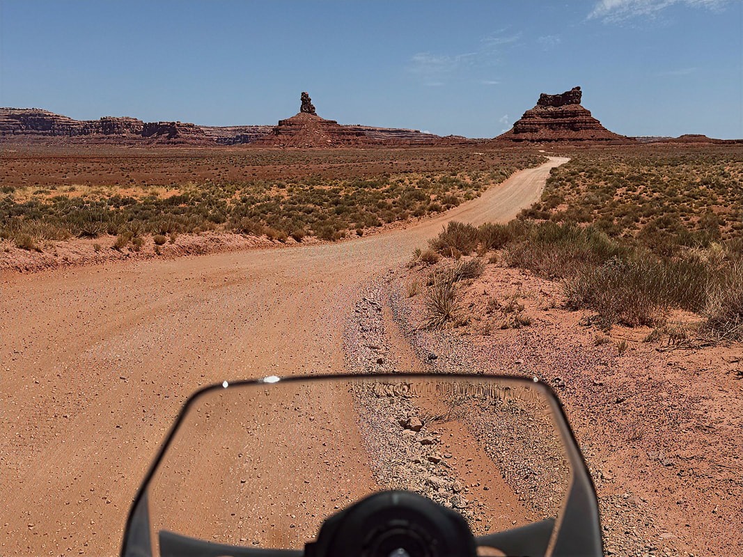
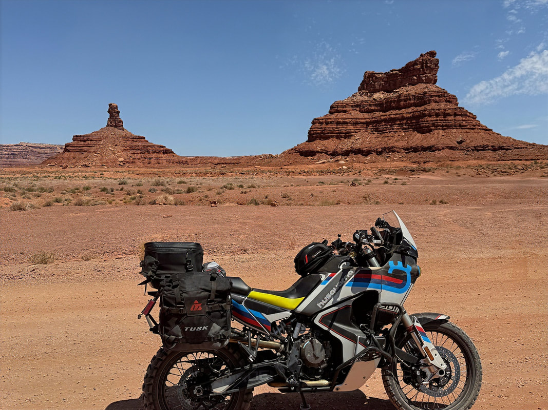
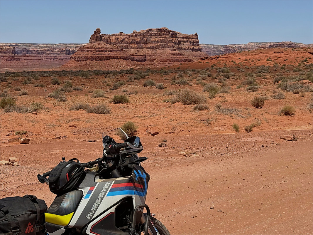
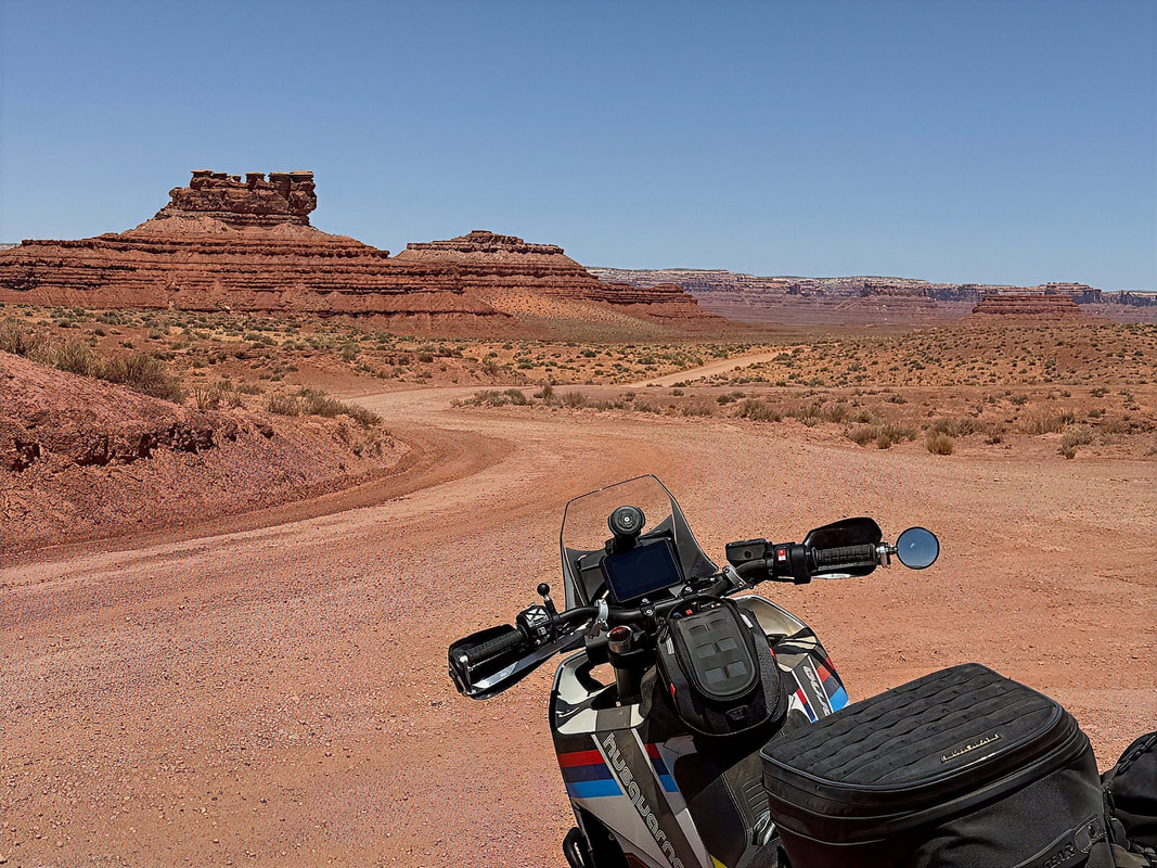
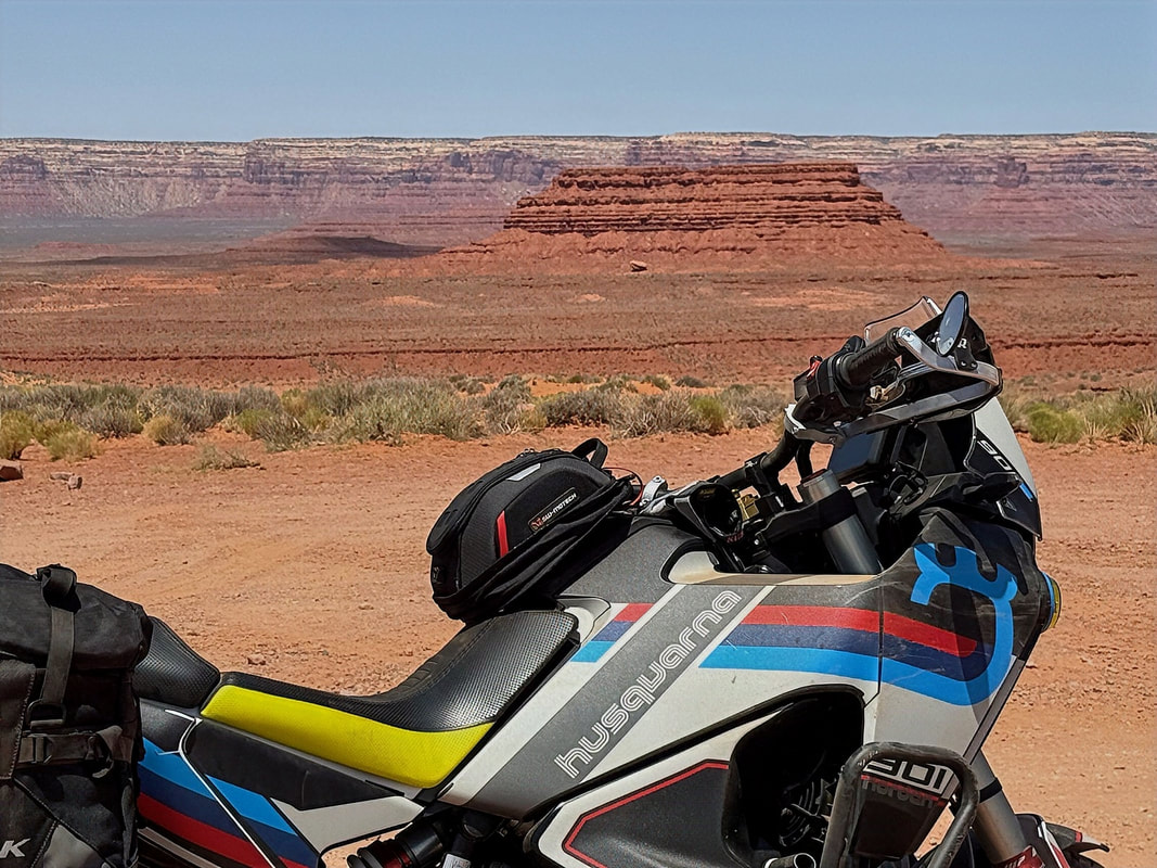
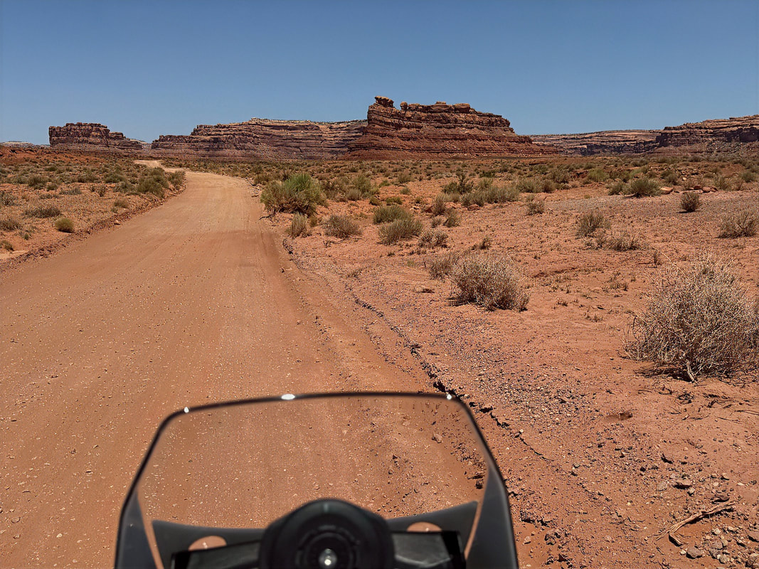
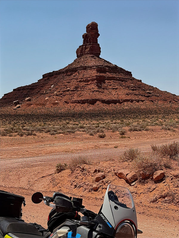
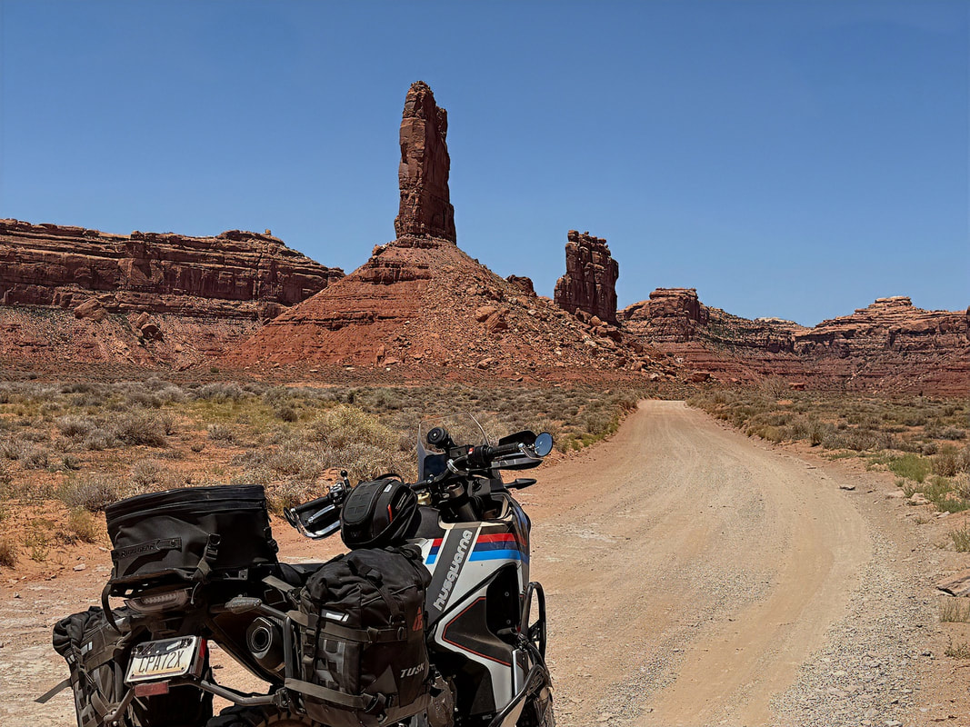
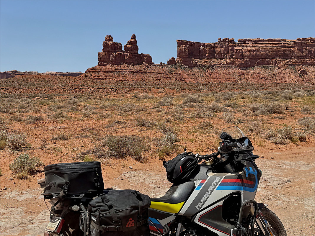
The highlight of the day was definitely the ride through the Valley of the Gods. The dirt road that winds through the valley offers spectacular, ever-changing views of towering sandstone buttes, monoliths, and mesas. It's like a more remote and low-key version of Monument Valley. Every turn brings a new photo-worthy view, and even though I’d been here before, it never gets old.
The highlight of the day was definitely the ride through the Valley of the Gods. The dirt road that winds through the valley offers spectacular, ever-changing views of towering sandstone buttes, monoliths, and mesas. It's like a more remote and low-key version of Monument Valley. Every turn brings a new photo-worthy view, and even though I’d been here before, it never gets old.
|
|
|
|
The valley road eventually connects back to Hwy 261, just below the base of the Moki Dugway, where I had climbed a few days earlier. From there, it was a short 10-minute ride back into Mexican Hat. I topped off the gas tank, grabbed some dinner, and got settled in for the night, ready to make the ride home tomorrow.
It was a mellow but scenic day, with a little bit of everything - Colorado detour, quiet highways, good food, and an afternoon ride through one of Utah’s hidden gems.
It was a mellow but scenic day, with a little bit of everything - Colorado detour, quiet highways, good food, and an afternoon ride through one of Utah’s hidden gems.
Day 6 - Mexican Hat to Havasu Lake City
Time to head home.
I was on the road before 7:00 AM, hoping to beat the worst of the desert heat. The forecast called for 110°F+ by the afternoon in Lake Havasu, so an early start was crucial.
Today’s ride would mostly retrace my Day 1 route in reverse - but to save time, I skipped the detour onto Hwy 66 and stuck to the main highways. From Mexican Hat, I headed south on Hwy 163, then west on Hwy 160, south on Hwy 89, west on I-40, and finally the home stretch on Hwy 95 into Havasu.
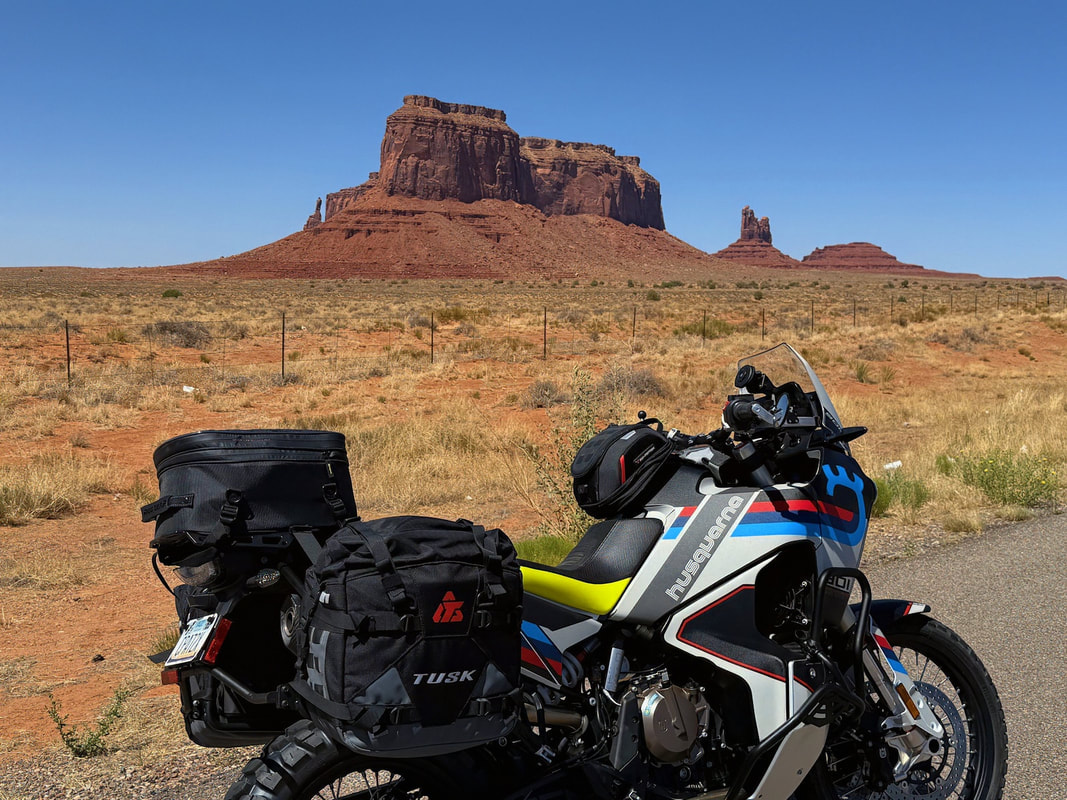
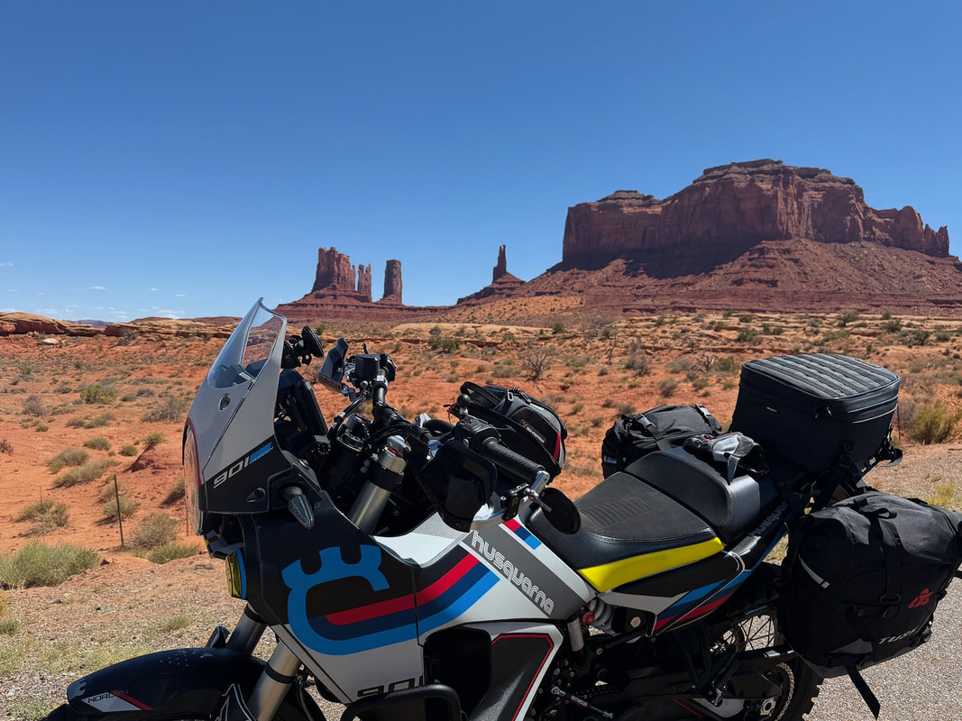
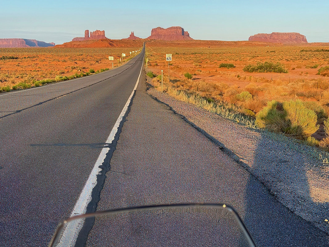
I only stopped twice for photos as I rode into Monument Valley. Even after seeing it a dozen times, those morning views are impossible to pass up without pulling over. The towering formations lit by the early sun never get old. You discover that during each hour of the day, the colors and glows of the terrain change.
Time to head home.
I was on the road before 7:00 AM, hoping to beat the worst of the desert heat. The forecast called for 110°F+ by the afternoon in Lake Havasu, so an early start was crucial.
Today’s ride would mostly retrace my Day 1 route in reverse - but to save time, I skipped the detour onto Hwy 66 and stuck to the main highways. From Mexican Hat, I headed south on Hwy 163, then west on Hwy 160, south on Hwy 89, west on I-40, and finally the home stretch on Hwy 95 into Havasu.
I only stopped twice for photos as I rode into Monument Valley. Even after seeing it a dozen times, those morning views are impossible to pass up without pulling over. The towering formations lit by the early sun never get old. You discover that during each hour of the day, the colors and glows of the terrain change.
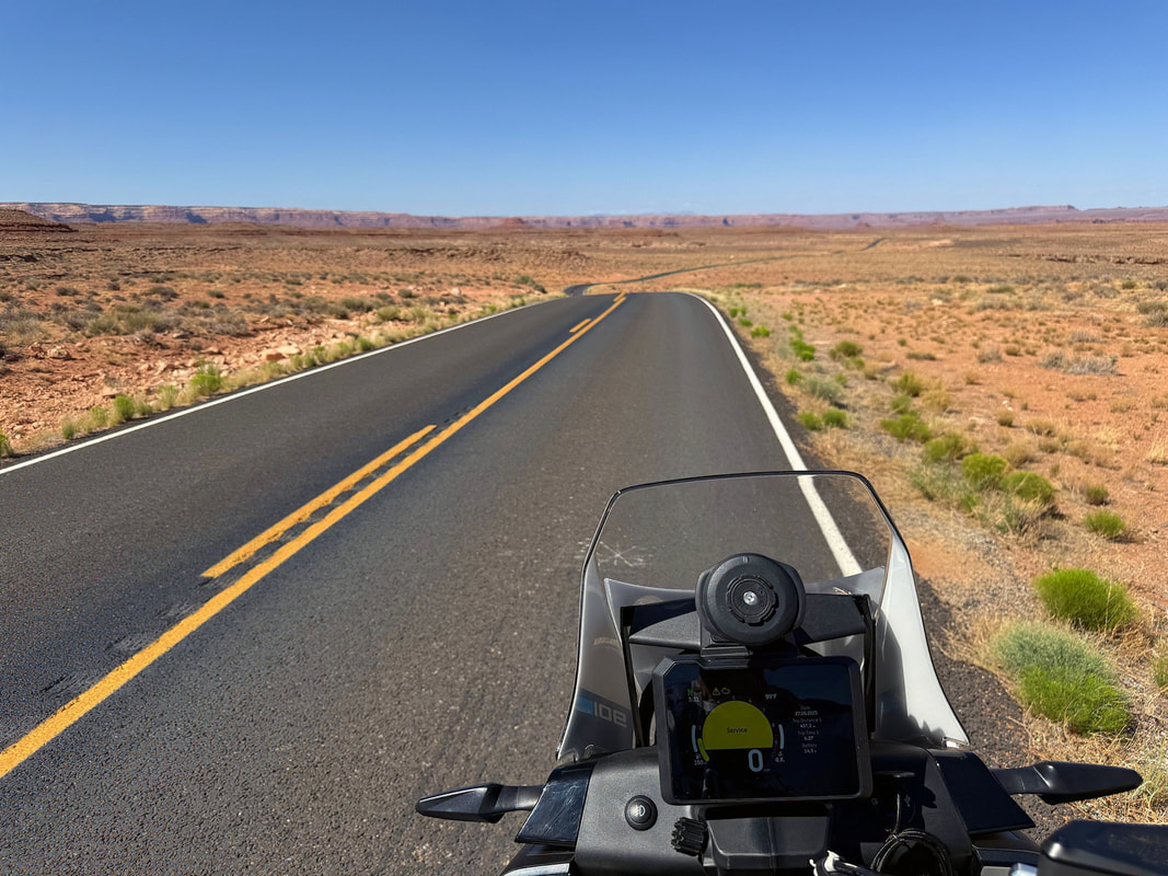
After that, it was a steady, relaxed pace toward home. I stopped for gas and a quick snack in Flagstaff, then pushed on. By the time I hit the intersection of I-40 and Hwy 95, the temperature had already climbed above 100°F. I made one last stop there for fuel, and more importantly, a cold drink before tackling the final 20-mile stretch into Lake Havasu.
I pulled into the driveway at around 1:00 PM, hot and dusty, but smiling.
It was a fantastic trip - six days, over 1,500 miles, and every one of them was worth it. The '23 Norden 901 ran flawlessly the entire way, handling everything from paved mountain twisties to dusty canyon tracks without a hiccup.
The riding, the scenery, the solitude - it all delivered. From the Moki Dugway and the Burr Trail, to Hell’s Backbone, Onion Creek, and Valley of the Gods, this ride reminded me why I love exploring the American Southwest on two wheels.
Mileage Recap:
Day 1 - LHC to Mexican Hat: 413 miles
Day 2 - Mexican Hat to Escalante: 231 miles
Day 3 - Escalante to Moab: 232 miles
Day 4 - Moab (Onion Creek Loop): 90 miles
Day 5 - Moab to Mexican Hat: 252 miles
Day 6 - Mexican Hat to LHC: 396 miles
Desert roads unwind,
Red rock cliffs and canyon winds,
Solitude on wheels.